
Alberta Bound on the Road Less Travelled


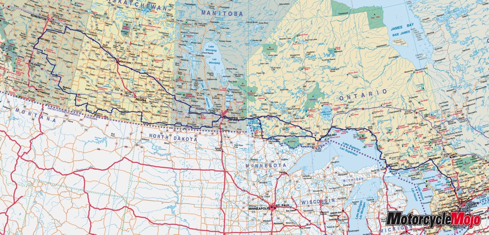
Over the years I have ridden to Canada’s East Coast many times. Depending on which part of Nova Scotia’s shoreline you choose to dip your front tire in, it’s a relatively easy 20 to 24-hour ride from my home. As much as I have wanted to, riding west however has never entered into the fray. Partly because my schedule does not allow me enough time and also the fact that it takes close to three days just to get out of Ontario. To put that in perspective, according to MapQuest.com, it takes almost 22 hours to travel from Central Ontario to Kenora, ON, but only a little over 17 hours for the rest of the ride through Manitoba, Saskatchewan and into Central Alberta.
It must be twenty years or more since I first heard about the ruggedness of Lake Superior and the twisting turning shoreline. The more I heard about it, the more I yearned to go. Also, as strange as it may seem, riding hour after hour on pancake flat ground through the prairies has also had a beckoning call to me. I have flown over the flat expanses of Canada’s prairie provinces many times but I have never had the opportunity to ride through them.
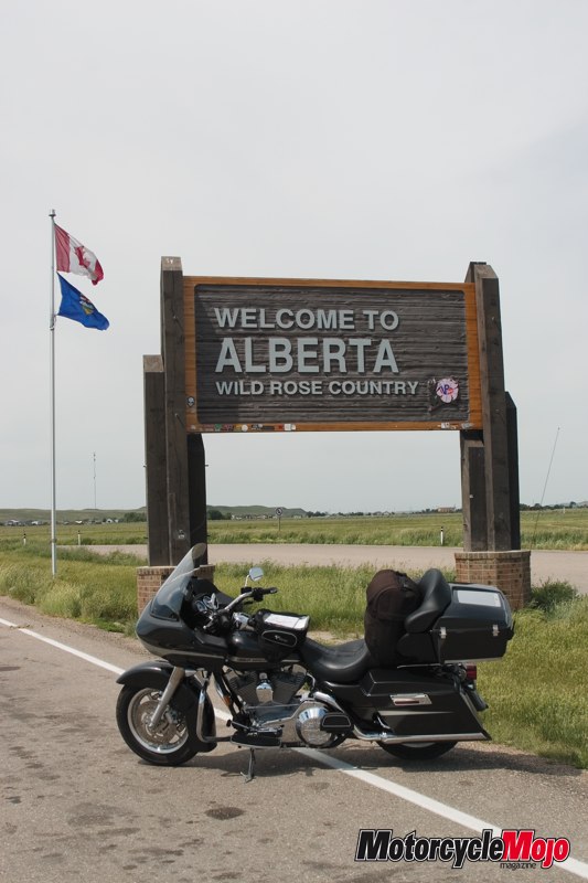
The Canadian Championship of Bike Building was being held in Olds, Alberta this year during the July long weekend. Although I wasn’t scheduled to attend for the third year in a row, I felt differently after it was announced that the custom bike area was being called ‘Motorcycle Mojo Custom Alley’. You can tell where I’m going with this diatribe, can’t you. Why not add another couple of thousand extra kilometres to my Lake Superior trip and check-off two long-awaited rides with the same twist of the throttle? So this summer I combined both those quests and headed out to Central Alberta.
My thought was to ride out west on more leisurely roads to enjoy the scenery and then take the Trans Canada back when I knew I would be pressed for time. I was told in no uncertain terms that I should be back for our 16th anniversary, which gave me 13 days on the road. That meant hard riding after the event and the need to stay on the good, straight roads.
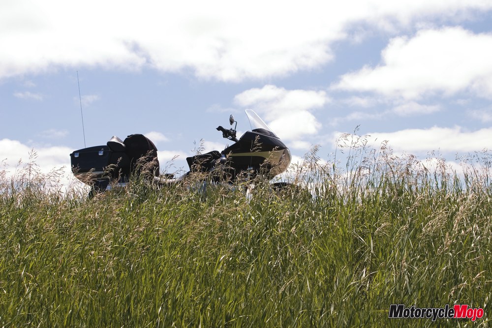
I rolled out of my driveway at nine o’clock Sunday morning. No small feat in itself. I had so many last minute details to look after the day before I left. This included attending a not-to-be-missed neighbourhood street party the night before which left little time to pack after arriving home at 1:30 a.m. No sense in planning too far in advance. I always figured that putting too much thought into packing results in hauling more than you really need. My late departure time actually worked out better because the morning was quite crisp at my intended ride time of 7:00 a.m. One item I packed this time was a ‘Gears’ (www.gearscanada.com) tank bag. Tank bags seem to be generally reserved for sport bikes and rarely seen on cruisers or touring bikes but, having all the necessary stuff like ear plugs, lip balm, sunscreen, gum or candies close at hand is very convenient, not to mention the clear map holder on top. Stopping to look at a map every so often is a huge waste of time and the tank bag allows you to view it on the fly and follow your progress. By the time I was on the road for a couple of days, I ended up with more stuff in the tank bag than I intended but it was stuff I used regularly.
I have been in Sudbury a few times, once to take our daughter to Science North, I also quickly passed through during two Iron Butt Saddlesore rides, and a ‘Ride to the Wall’ ride last year. I have only ridden farther west than Sudbury once. About 18-years ago we rode south from Espanola after a wee boat ride on the MS Chi-Cheemaun from Tobermory to Manitoulin Island during a loop of Georgian Bay. After my first four-and-a half hours of riding, I was in unknown territory.
It’s pretty easy to recognize Sudbury. It has a lunar type atmosphere of rolling rock with stunted greenery growing on it. It was only in the last few decades did any of that rock, or much of the whole area for that matter, have any greenery I learned on my trip to Science North many years prior. The pollution from the smelters’ huge smokestacks that pierce the horizon caused so much soot to settle on the city that it stunted most vegetation growth.
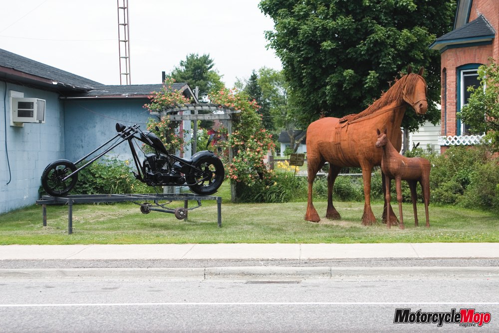
Highway 69 turns into Trans Canada Hwy 17 at Sudbury and travels along the top of Georgian Bay and Lake Huron to Sault Ste. Marie. Just west of Espanola is a small town named Massey. An indiscriminate little town of no real interest to a passer-by except for the steel sculptures that dot the main street. Most of the sculptures that greet the traveller are of proportionately correct horses that gave me the impression that they were sculpted in the likeness of Pony Express horses outfitted with saddle, small saddlebags and reins tied up to a steel hitching post. Other roadside sculptures included a buffalo and a horse teamed to a single blade walking plow with a man at the reins. The one that initially caught my eye was a long-forked chopper mounted to a trailer beside two steel Clydesdales – iron horses past and present I thought. Apparently a local gentleman by the name of Laval Bouchard likes to weld the sculptures together and place them on the main drag to catch a traveller’s eye. It works.
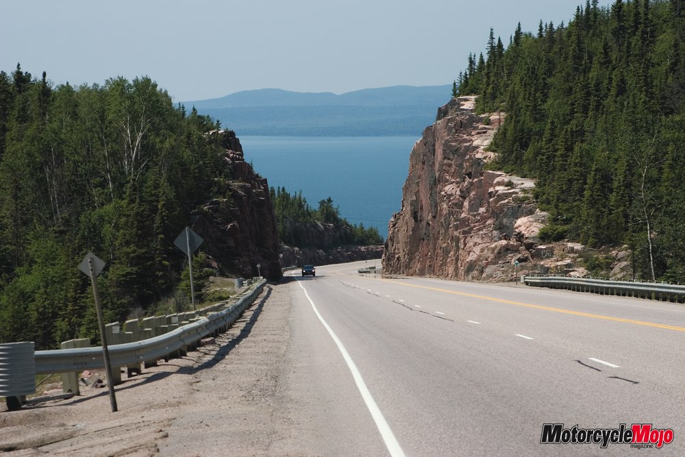
At Sault Ste. Marie, Hwy 17 now heads north and this is where the road becomes the most entertaining and was exactly as I expected. Following this route north seems like a constant sweeper to the left and the right as the road separates the shoreline of Lake Superior and the rock outcroppings that are part of the Canadian Shield. Also very impressive are the massive rockcuts through solid granite that the road passes through. These rock cuts are a mainstay surrounding Lake Superior, the world’s largest freshwater lake, and are even more impressive north of the ‘Lake of the Woods’ in the Kenora region. Granite of the Canadian Shield can be found in all provinces from Alberta to Labrador. Covering two-thirds of Ontario, this Precambrian rock formation is more than 570 million years old.
The area reminded me of a few different places in Canada I have ridden through. Newfoundland, because of the enormous exposed rolling rock. Cape Breton, NS and the Gaspe Peninsula, QC, for the rolling hills covered in trees for as far as the eye can see and the twisting turning roads. This region also reminded me of the Parry Sound area for the huge rock cuts, and Ontario’s Muskoka area for the many lakes that shape the road, albeit minus the tourist traffic plugging up the roads and endless stretches of shoreline exposing cottages and boathouses of all shapes and sizes.
Surprisingly, in such a rock infested part of the Canadian Shield, the eastern side of Superior has a lot of sand beaches. I thought that in mid-June the water must still be pretty cold in such a huge northern lake but I did see people wading in it. The temperature got real chilly when riding beside the water so I had to stop to feel the water myself. Let me just say it gives a whole new meaning to the term ‘shrinkage’.
Just north of Montreal River, the road takes on some pretty high elevations mixed with tight sweepers offering some of the finest riding roads I have ever been on and the pavement was perfect.
I ended my first day’s ride of 885 km in Wawa. A quick pass through Main Street revealed a town that has seen better days. Many motels and restaurants had closed up and appeared to have been vacant for many years judging by their exterior condition.
The following morning I left town at 7:30 a.m. with my fuel gauge showing just shy of a half tank of gas. Aware of this, I thought I would fill-up at the first truck stop once on the highway. After 35 km north of Wawa on a lonely stretch of Hwy 17 I turned around for fuel. The future was uncertain but I knew what I left behind so the safest choice was to go back and fill up. The fuel gauge on my Road Glide, as other Harley touring bikes I have noticed, is merely an indicator and needs to be understood. The first half of a full tank gives about 250-270 km, depending on riding conditions, and then starts a quick decent to empty. That quick drop leaves only about 100 km of fuel left. They say experience is the best teacher. The same fuel decision happened to me in Newfoundland last summer while I was riding the Northern Peninsula. I was at the very northern tip in St. Anthony and turned around to continue on my way only to realize a half-hour into my travels that I was bound to run out of gas unless I found a station soon… so I headed back to St. Anthony and ended up staying there for the night. You’d think I’d learn after the first time.
While speaking with the pump attendant during my second visit that day to Wawa, I learned that the town had a bad turn in 1979. Forestry and mining iron ore were the town’s main industry but forestry took a serious downturn and the mine closed in 1979. About a thousand people left and that was the start of the town’s decline. There is, however, good news in the town’s future, with gold mining now in the area and there’s talk of a diamond mine opening up soon. Hopefully this once lively town will get back on its feet again and reap the rewards of industry.
Leaving Wawa, ‘Take Two’, took place at 8:30 a.m. with a full tank of gas this time. After riding to the next town, White River, my hunch was correct in that I would have run out of gas. I later realized that many of the gas stops in unpopulated areas are operated by individuals who might only have one flavour of gasoline and possibly a diesel pump, and they close up shop at 5 p.m, something to keep in mind.
My first departure from Wawa was a crisp sunny morning, perfect for early morning riding but that would all change on the second venture out of town. I soon rode under heavy black storm clouds shortly after leaving Wawa and I seriously hoped this wasn’t the aftermath of Manitoba’s bad weather. The night before I was watching the Weather Channel to see the upcoming forecast and found out that the two previous days, Southern Manitoba had eight devastating tornados touch down lifting houses off foundations and tossing transport trucks off the Trans Canada highway. The twisters were categorized as F3 and F4. F4 meaning winds in excess of 330 km/h. My morning ride got cold really fast with a little rain and lightning but with the illusion of blue sky far off in the distance, I hoped I could ride out of it. As usual, I held off donning my rain suit as long as possible, a practice that has seen me get wet many times. Luckily after 45 minutes I rode out from under the threatening sky and was still dry. The rest of the day was sunny and extremely hot save for about a half an hour of cold thick fog around Marathon.
Just east of Nipigon is where Trans Canada Hwy 17 meets up with Trans Canada Hwy 11 and both roads share the pavement until the road reaches 60 km west of Thunder Bay when Hwy 17 heads north to Dryden and Hwy 11 stays pointing west to Fort Francis. It was in this area I saw my only bear on this trip as he crossed the road in front of me. In the Nipigon region, shear verticle rock outcroppings stretched skyward for maybe 150-200 feet as if they just burst straight up out of the ground.
I chose to ride on Hwy 11 to Fort Francis on my way west as opposed to Hwy 17 that would take me through Dryden.
Once inland of the Lake Superior shoreline the roads still provided some curves but for the most part, straight was the order of the day’s ride. Major construction in two areas provided for some time to sit and bake in the heat while waiting for about 15 minutes each time for the pilot truck to return.
I finished my day’s ride of 938 km in Fort Francis at about 7:30 p.m. EST (I had entered Central Standard Time a few kilometers west of Thunder Bay).
Severe thunderstorms were forecast for the day but I didn’t need the Weather Network to tell me. There was a deluge of water falling from the sky and the hotel parking lot was covered in large puddles when I woke up. I left Fort Francis a little later than I would have liked but my procrastination paid off. The storm reports were calling for in excess of 50 mm of rain per hour but when I left the rain had passed. Apart from riding under heavy black storm clouds for most of the morning, I didn’t get wet until later in the day.
A little time can be saved, according to MapQuest.com, by traveling to Winnipeg through the States but my original intent was to stay in Canada for the whole trip. Leaving Fort Francis I continued on Hwy 11 to just west of the town of Emo where I took Hwy 71 north to Kenora. This Hwy starts off arrow straight to the southern part of the ‘Lake of the Woods’ area but after entering the lake region it becomes quite entertaining, which was my hope, and the reason for choosing this route.
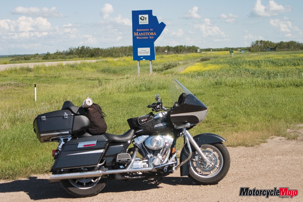
My first stretch of rain since the start of the trip was from Kenora to the Manitoba border (2,100 km from my starting location). At 11:30 a.m. I crossed into Manitoba after 280 km of riding. Oddly enough, when I reached the Manitoba border the skies ahead were showing signs of blue and the rest of the day was sunny with huge white clouds blocking the heat of the suns rays on occasion.
The long and not so winding road
After 120 km of Manitoba’s Trans Canada Hwy 1, I entered Winnipeg’s Ring Road, a road that circumnavigates the city and allows one to simply by-pass the city without having to enter it.
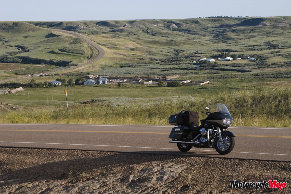
My intended route was to head south and then west and try to stay off the Trans Canada from now on until my return voyage. For this I enlisted some fine reference material. Celebrated Canadian author and motorcyclist extraordinaire Max Burns wrote a travellogue for the unhurried called ‘These are a few of my favourite roads’ and uses the all-explaining by-line ‘The most expedient route to cross, and see, Canada slowly (according to Max Burns)’. Max emphasizes his hatred for the ‘Trash (Trans) Canada’ and details various ways to get from coast to coast by way of less travelled routes and throws in some expected scenery, good restaurants, tea rooms and Bed and Breakfasts to enhance his recommended travel. One of Max’s paths for traversing Manitoba is to take Hwy 3 that is accessible from Winnipeg’s Ring Road and heads south before turning west. I was also told from another source that the south end of the Prairie Provinces is more entertaining than the middle. I took Max’s advice and while it is still flat, it does offer up some curves and a few hills, not much, but a few. The small town of La Riviére actually offers a few tight turns while heading down into its valley and a few more tight turns while leaving town. It was so much fun in an otherwise flat, straight landscape that I had to do it again, and then again to continue heading west. There is even a ski hill on the west side of the valley, although I think the road would prove more fun since the ski hill is just that, a hill.
The sky here is huge, probably because you can see for miles in any direction without so much as a hill interrupting your view, except in La Riviére of course. There isn’t much traffic but when a vehicle is seen in the distance coming toward you, it’s hard to tell exactly what it is. First it might look like a person, then a motorcycle, then a car or pick-up and it may very well end up a tractor trailer as it gets closer. As flat as the roads are, I also had the uncanny feeling I was constantly climbing in elevation. I don’t have a GPS so I may never know but the flatness and the distance can be very deceiving.
I was now in the same area that the twisters did devastating damage only 3 and 4 days previously. While the bad weather was gone leaving sun and clouds, the wind was still very heavy. Hwy 3 zigzags north and south in short stints while heading west and the wind had made a significant dent in my fuel mileage. My usual half tank range of around 260 km was now only 200 km because of the wind coming from the west. While on the north and south roads, I had the bike heeled over to about a 75° angle. The change in mileage means instead of getting an average of 5L/100 km (57mpg), on this leg I got only 6.3L/100 km (44mpg). I holed up for the night after a 770 km day in Boissevain, MB, just a few kilometers north of Hwy 3 on Hwy 10.
While checking out of Boissevain, the next day, the woman behind the counter told me that her nephew’s wife’s parents lost everything in one of the twisters. Apparently they had just made it to the basement when their house blew apart, including sucking the basement stairs out. Everything they owned, from a tractor-trailer to farm equipment, was strewn about in neighbouring fields.
The day began cold at 5° with a brisk wind. After riding for a couple of hours, I decided to put on my PUG (www.performanceundergear.com) undershirt and neoprene Kayak gloves that I use for cold or wet weather to block some of the wind. PUG makes warm and cold weather underwear that really does make a difference to your body temperature. The air finally began to warm up around 1:30 after the clouds broke.
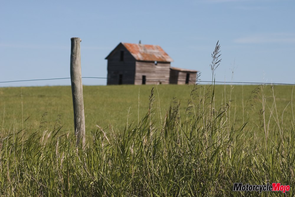
While looking for a coffee shop to warm up in I soon came to realize that just because a town appears on the map doesn’t really mean there is anything there. Many towns are just a crossroad with a few houses and might have a single business. One such business that caught my eye was Seed Washing. Now, I’m not a farmer but, aren’t seeds clean when they come out of the husks or pods, and don’t they just get dirty when they go in the ground anyway?
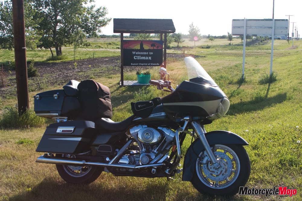
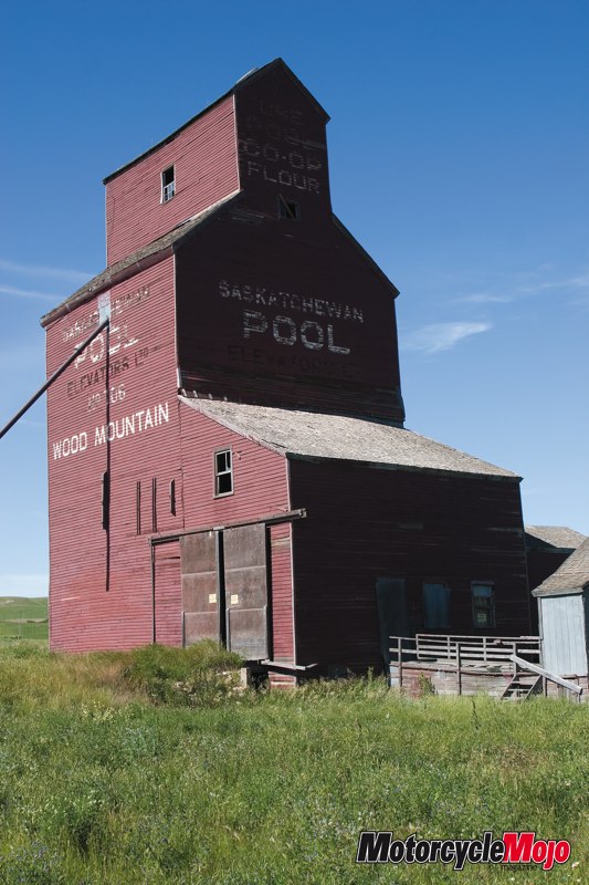
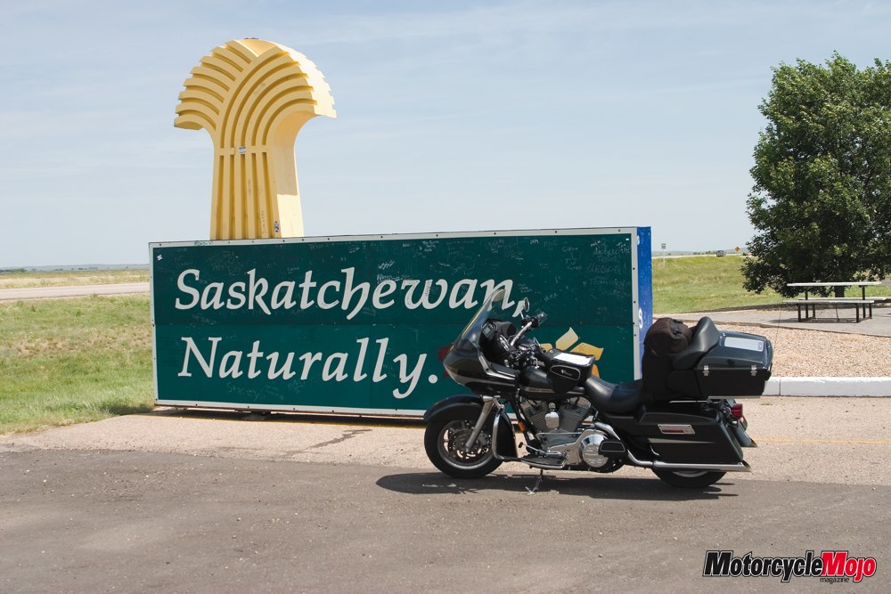
My intention was to keep on Hwy 3 in Manitoba, which turns to Hwy 18 once in Saskatchewan. Shortly after entering Saskatchewan I rode into Oxbow, my first of many views of what Southern Saskatchewan was really like with its many scenic river valleys that generally offer beautiful vistas and a nice ride down into them and back out. The Moose Mountain Creek Valley, just inside Saskatchewan, was one of the first to offer such scenery. I intended to stay on Hwy 18 to ride along the top of Grasslands National Park until the town of Climax. Here, I was going to head north and find a place to stay for the night.
I ran into gravel on Hwy 18 at the intersection of Hwy 35 that didn’t show on the map so I turned north onto Hwy 35 to Weyburn, and then to Hwy 13 west. Although it added a fair bit of travel time, it wasn’t in vain for if it weren’t for that detour I would have never found a hidden gem of a road, Hwy 358. Searching the map for an alternate route back to Hwy 18 while heading west on Hwy 13, I chose the curviest road I could find on the map and it didn’t disappoint. At Limerick, I turned south onto Hwy 358, just west of Assiniboia. Hwy 358 was a skinny road totally devoid of traffic with some nice scenery and lots of curves. In fact there were more curves on that road than I had seen all day. It was on this road that I saw my first prairie dog, and hundreds more at the same time. I guess the road less traveled equals tan time for the little varmints. They were standing, sitting and lying on the road, and soon running for cover as I approached. They can move pretty fast for only having little one-inch legs. The prairie dogs seemed a little kamikaze, taking off from perfectly safe ground cover on one side of the road to run across right in front of me to the other side. Although I didn’t see any other traffic, it was evident that not all prairie dogs live to tell of their daring escapades. This area was also a good place to watch out for antelope. I thought they were small red deer but I was corrected by one of the locals later in the day. The antelope are small and while they would do their fair share of damage to a bike, it’s best to keep in mind that there are full-size whitetail and mule deer in the area as well.
The area reminded me of the gentle rolling hills of Ireland and I wondered because of the Irish town names like Limerick, McCord and Glentworth if the Irish settlers didn’t settle here because it reminded them as well of their homeland.
One thing I noticed in the areas of Southern Manitoba and Saskatchewan is that every person in a vehicle I passed on the road waved, even two guys talking while leaning on the back of a pick-up truck, the vehicle of choice it seems, both took the time to wave. Perhaps they don’t see too many two-wheeled travellers.
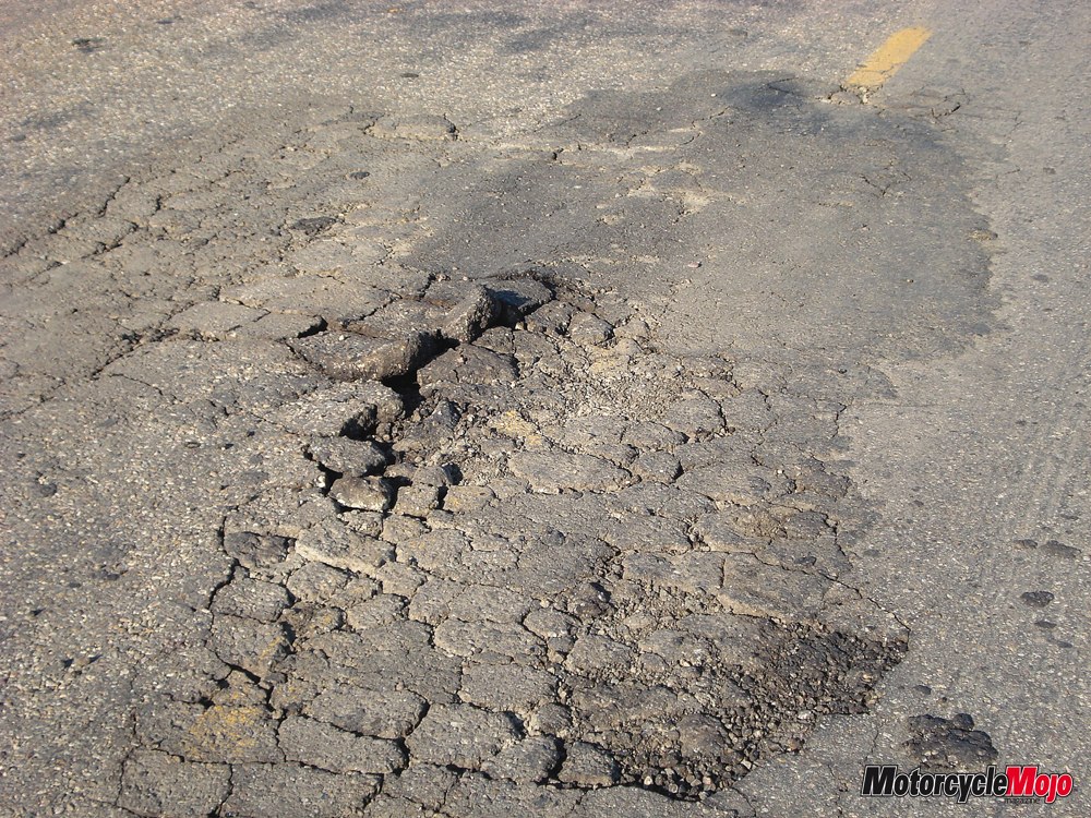
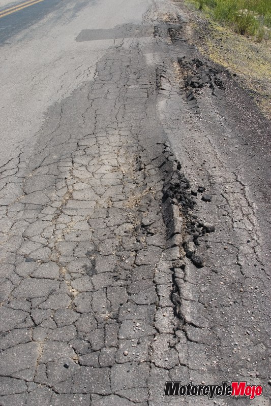
Hwy 358 took me back to Hwy 18 and the scenery was great, at least for awhile. If I had known what was in store for me I would have turned north onto Hwy 19 but continued on 18 to worse pavement and more holes to avoid until it got to a point I was riding at little more than crawling speed. The section before and after the town of Val Marie was easily the worst pavement of the whole trip.
I did get to Climax and turned north on Hwy 37 as planned. Hwy 37 started out as bad as 18 but soon improved. About half way to Shaunavon, my intended stop for the night, the road was glass smooth and led me into Frenchman River Valley, a beautiful deep valley with a few houses and of course, Frenchman River snaking its way along the bottom. There have been quite few times on this ride that as I rounded a corner, a view unfolds that will knock your socks off and this was one of them. Not bad for a ‘flat province’. I finished the day’s ride at 863 km but the time I was in the saddle threw me off since Saskatchewan doesn’t recognize Daylight Savings Time like every other province in Canada does. Even though Saskatchewan and Manitoba are in the same time zone doesn’t mean it’s the same time, it depends on the time of year and if DST is in effect. Even the waitress in the restaurant that evening was confused and couldn’t tell me if the time was the same as their neighbour to the east.
My planned route for Thursday would be Hwy 13 from Shaunavon, into the town of Eastend and eventually to Hwy 21 north, then through Cypress Hills Park to the Trans Canada west and into Alberta.
One of the attendants at the Alberta Info Centre suggested a route for me to take in the general direction of Drumheller. As a kid I wanted to be all the regular things a kid wants to be, a fireman, an archeologist, a doctor, you know the usual stuff. I thought the fireman gig was too strenuous, I tried the white coat, stethoscope and doctors name badge but the girls didn’t buy it. Anyway, I have always had an interest in dinosaurs so since I was here, I had to check out the Dinosaur Provincial Park. To get there the Information Centre attendant suggested I take the Trans Canada to Hwy 884 north at Ralston and continue to Hwy 544 and shortly after getting on this road, watch for signs to Dinosaur Park.
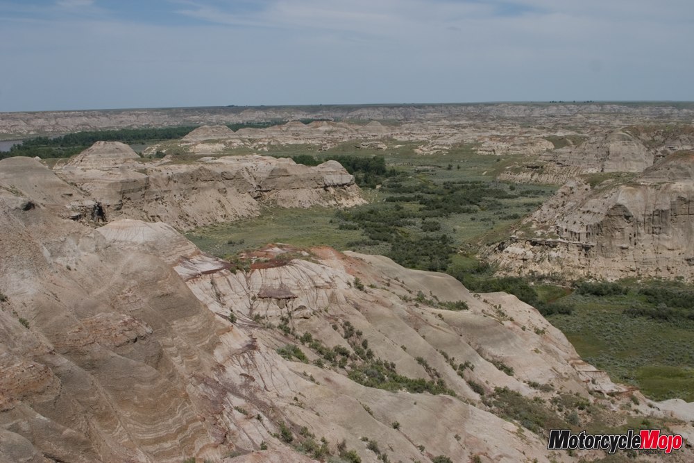
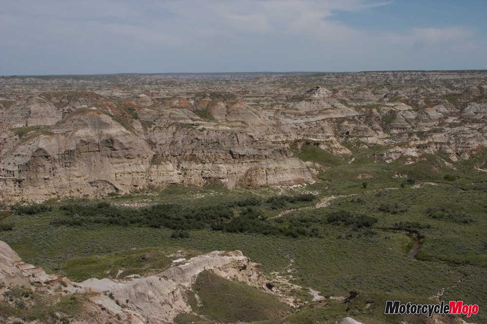
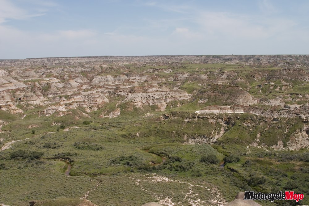
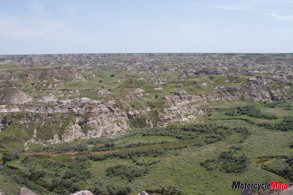
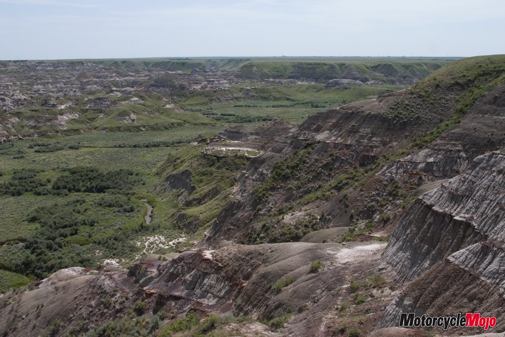
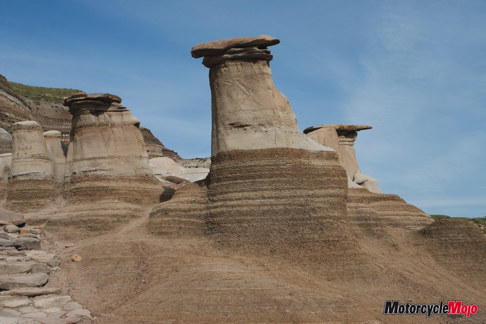
The Canadian Badlands
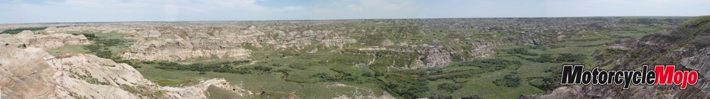
What an awesome sight. Never mind that this is the largest dinosaur graveyard in the world. The view gets better and better with each step you take toward the edge of the cliff. Standing on the edge of the cliff that looks down onto the Red Deer River is the most amazing sight I think I have ever seen. Millions of years of erosion have left the most mind-blowing views of caverns, Hoodoos and rock formations. A definite must-see if you are ever in the area. Although the river is quite wide when you are beside it, it looks like a piece of string when looking down on it from the top of the bluffs. As with any scenery photos, the image on paper never does the real landscape justice but can only jog your memory of the amazing sights.
Apparently this area was the site of the ‘Dinosaur Rush’. During the first half of the century, much of this area was severely damaged by those looking for dinosaur bones, many of which ended up as decorations in private rock and flower gardens. In 1955 the area was declared a ‘United Nations Heritage Site’.
From there, my destination was Drumheller. I exited the park road and got back on Hwy 544 to Hwy 36 north. You might want to chug an energy drink first to keep awake, this is one flat boring ride. Once you reach Hwy 570, the boredom continues until the road descends into the Red Deer River Valley. At a town called Dorothy, Hwy 570 changes to Hwy 10 and the amazing erosion begins again except this time you are in the middle of it instead of looking down on it. The Hoodoo Trail follows the river and on both sides are breathtaking cliffs that took millions of years to form for your viewing pleasure. Be sure to stop at the Hoodoo Recreation Centre for some close-up Hoodoo photos, no trip to the area is complete without them. Drumheller is just a short few kilometres up the road once you leave the valley. All the roads I just mentioned in Alberta are smooth and some are brand new making for perfect bump free riding, a real treat after the patchwork of Saskatchewan roads.
I’m still shaking my head for doing this but Friday morning I had a date at the Dinosaur Park. I prepaid $8 for the 1:00 p.m. guided bus tour. I would rather ride than do anything touristy but the inner archeologist in me came out and I figured this way I could show up last minute and have a seat waiting for me.
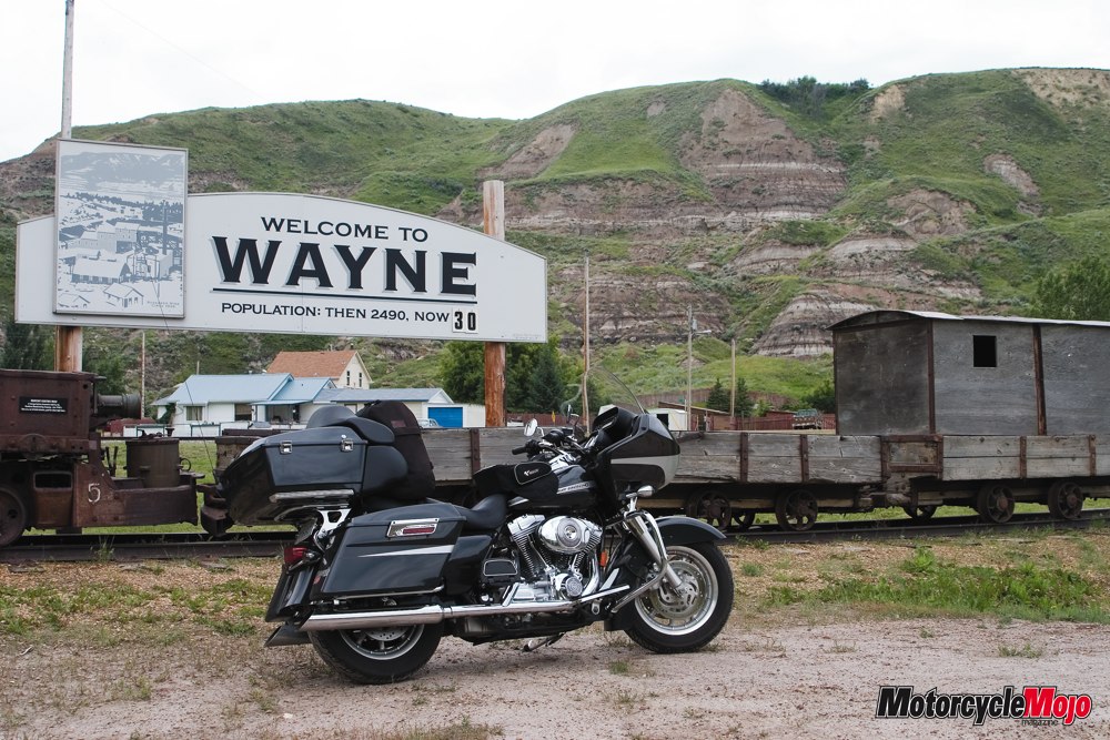
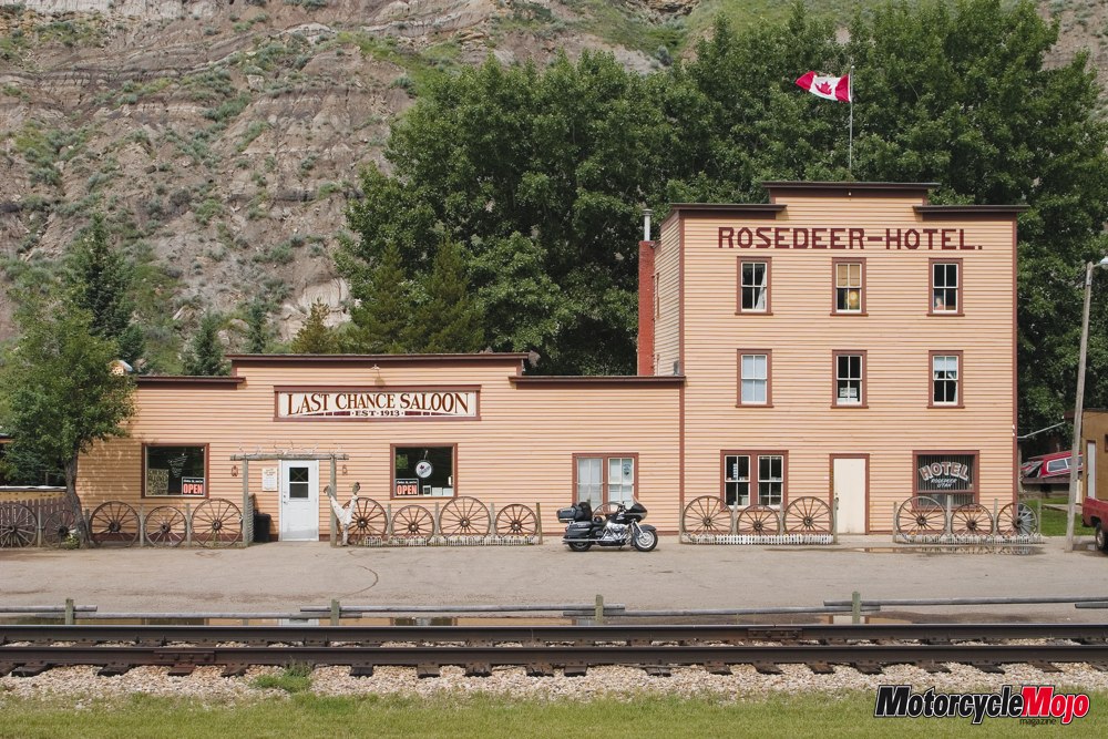
Booking the 1:00 tour meant I could ride all morning to places like Wayne, the original town of the Drumheller area during the coal mining hey-day of the region where the Last Chance Saloon still operates today but not much else. After crossing eleven bridges in the six-kilometre ride off the main highway, the town sign says it all, Welcome to Wayne – Population: Then 2490, Now 30.
After Wayne I rode the Dinosaur Trail, a 48-kilometre loop that took me northwest of Drumheller through the Red Deer River Valley on both sides of the river. A nice ride with some pretty substantial elevation changes, tight curves and a short ferry ride across the river on the north end of the loop. Bruce, the ferry operator, was very helpful explaining some of the local geography. Don’t expect to be in a hurry though. While spending time showing me the area on a map, the ferry had yet to leave the dock. I mentioned to Bruce that he should get the ferry going, he just looked at the loaded cars and continued on with my geography lesson. To be honest, if you’ve seen Dinosaur Provincial Park and the Hoodoo Trail, this is the same stuff but regardless, it’s an excellent way to kill an hour or so.
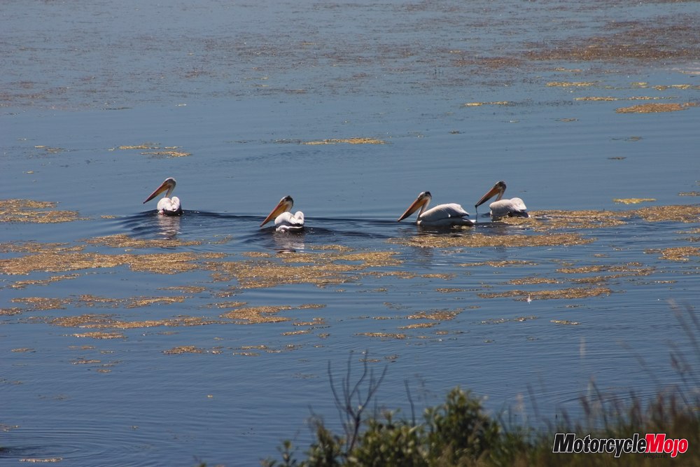
It was while I was stopped at Horsethief Canyon look-off on the Dinosaur Trail that I saw my first pelican outside of Florida. And I thought seeing seagulls in the prairies was strange, but a pelican? As I was relaying this sighting to a few people later on I was told that pelicans do, in fact, exist in Alberta. Go figure. On my ride home I happened to spot four of them swimming in a large pond in Saskatchewan so I had to turn around to get a photo just to prove that they do exist.
When I began to head back to Dinosaur Park for my 1:00 p.m. bus tour, I was riding directly into some of the most serious weather I’ve seen on this trip. I think it was the many horizontal lightning strikes that convinced me to turn around. I couldn’t see the sense in spending 8 or 10 bucks in fuel to ride through a lightning storm to sit in a bus, possibly in the same lightning storm. I figured I’d take the loss on the ticket, stay dry and save the gas money. I turned around and headed for whatever bright sky I could find in the general direction of Olds, AB. It was actually kind of fun. It’s been a long time since I’ve had nothing better to do but to point my bike in whatever direction the sky told me to and chase the brightest sky trying to outrun a storm. It worked pretty well too. I had black skies and lightning to my south and the same to my north, I was in a little pocket of grey sky but my luck eventually ran out and I caught about 5 minutes of rain just as I was rolling into Olds.
Canadian Championship of Bike Building and Motorcycle Trade Show
This event was ultimately the reason for my travels across the western half of Canada. I did run into my fair share of black, lightning stricken clouds the day before the event started but luckily for the event organizer, Belt Drive Betty (www.beltdrivebetty.com), the weather cleared and Saturday was the start of a beautiful weekend.
For more on the Canadian Championship of Bike Building (CCBB) see page 50
The ride home
I knew before leaving for this trip that I’d be booting it home on the Trans Canada but was told by a few riders on the way, and fellow riders at the CCBB, that the Yellow Head (Trans Canada Hwy 16) would be much more entertaining instead of TC Hwy 1 that traverses all the western provinces. Having never been on TC Hwy 1, I could not compare but the Yellow Head did have some scenery to look at although it was still pretty flat.
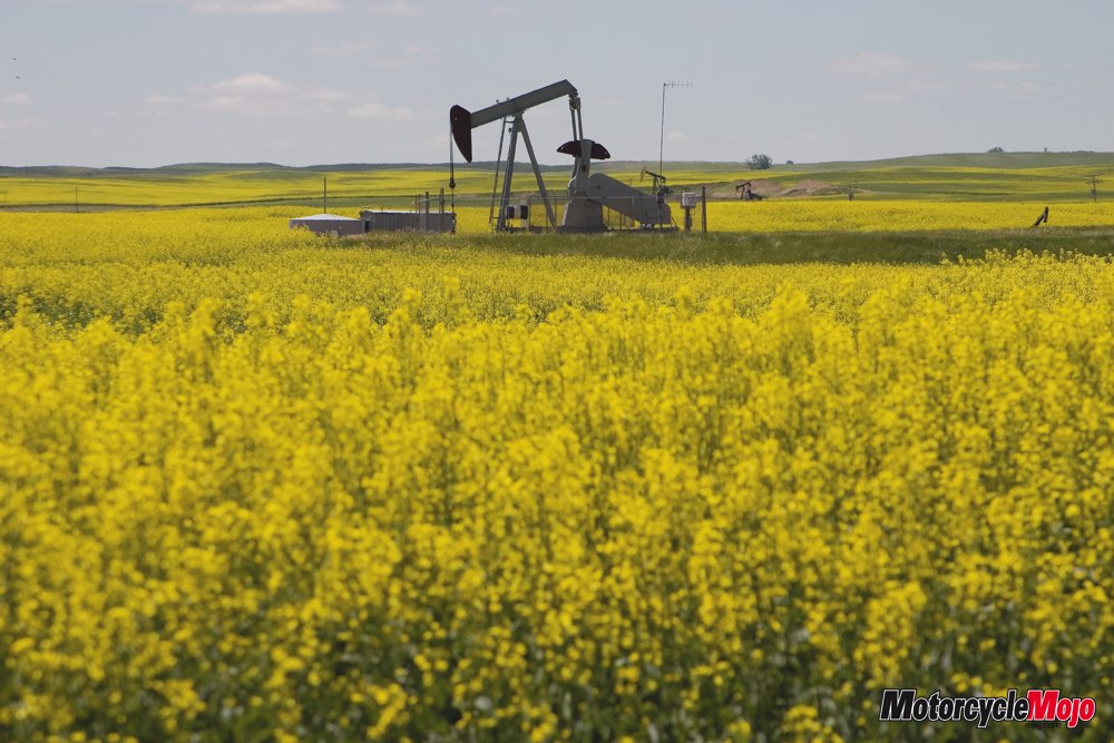
I left Olds on Monday at around 3:00 p.m. and headed north toward Edmonton. I exited Hwy 2 on Hwy 2A at Morningside to get off the busy highway and once in Wetaskiwin, I turned east on Hwy 13. In Camrose I got onto Hwy 26 until I met up with Hwy 36 which took me to the TC Yellow Head Highway 16 and points east. Much of the highway was lined with yellow as far as the eye could see from the massive fields of canola.
I stayed the night in Lloydminster on the Alberta side of town. Lloydminster is the only provincial border town in the country and I couldn’t help but wonder, what happens if you move to the other side of town? Do you need new license plates and ownership for your vehicles? What about any Provincial Government issued documents? Since Alberta has no provincial sales tax, I’m sure the Alberta side is the busiest, as far as retail is concerned anyway.
My intent was to stop by and see Brent and Derek at Cycle Boyz Customs in Brandon, Manitoba, on my way through the area, so at Minnedosa I turned south onto Hwy 10 straight into Brandon. The Boyz have a good sized, well-outfitted shop not too far from the highway so it was a breeze to find. I left Brandon on TC Hwy 1 through Winnipeg and once inside Ontario I stayed on Hwy 17 at Kenora. This took me through Dryden this time and 12 hours after my departure from Brandon I rolled into Thunder Bay where I stayed for the night.
In the hotel parking lot, I parked close to four other bikes that looked like they just exited the showroom floor and I motioned to the one guy who was still wiping down his bike, how much for him to clean my bug splattered bike? After a little chitchat and introduction, I discovered that the four were from Florida and I was ensured that their bikes had lots of road grime on them before washing. I commented on the spotless bikes and the Floridian divulged his secret. He opened his tour-pak and showed me a box of no-name anti-static dryer sheets. In my disbelief he handed me three of them and simply said, “try ‘em”, in his unique southern drawl. He continued, “I don’t know if it’s the oils in them or what but they sure do work”. I was skeptical but after looking at my bug infested fairing and glancing again at the four spotless bikes beside me, I accepted his offer.
There was threat of rain the following day according to the Weather Network and my windshield was so thick with bug carcasses, I couldn’t see through it. It’s a good thing I look over the top, but if it did rain and the water came over the top, it’s a no-brainer that I’d be eating bug soup. Since home was still 16 hours away, I intended on taking two more easy-riding days and that left me plenty of time to give my bike a bath the next morning. A perfect time to try out the dryer sheets.
I did as the southerner said, “Wet the bike, wet the sheet and rub lightly”. I started slow in an inconspicuous piece of chrome and moved on to a corner of paint as instructed. To my amazement it was working. Seven days of sun-baked, wind-blasted bug guts were easily lifting off the paint and chrome and as a bonus, left a shimmering static free smooth surface to be dried off. Ok, now for the disclaimer. I am just passing on a hint that was passed onto me. If your paint falls off on the road because you tried a fabric softener sheet, don’t come running to me. It worked for me and my paint was fine, static and bug free, and if a person were to check, it probably smelled daisy fresh too.
I left Thunder Bay in 80°F temps (my bike has a Fahrenheit temp gauge) but once I rounded the eastern shore of Superior, the temperature dropped to below 60°F. I had been told that weather is very un-predictable in this area and it’s no wonder. With temperature changes like that, they probably have their own isolated weather systems plaguing the area. I rode into some nasty black clouds dumping heavy rain and horizontal lightning once again. I was glad I washed the bike. This would prove to be the second half of the one hour’s worth of rain I encountered on the whole trip. Other than this heavy downpour, I ran into about a half an hour of rain west of Kenora on the way out and about five minutes just outside of Olds. Not too bad – about one hours worth of rain in approximately 90 hours riding.
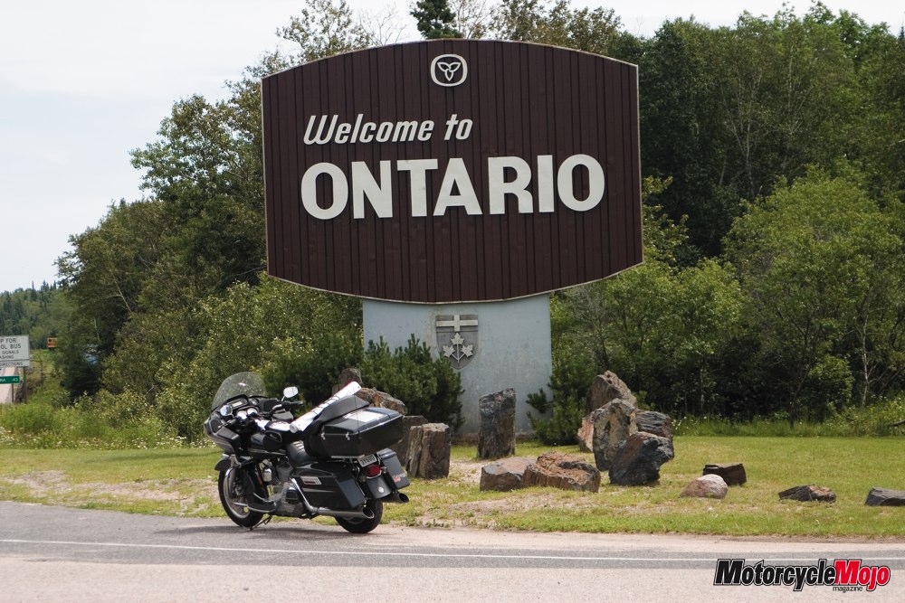
I retraced my tire tracks from this point staying on Hwy 17 and I once again, rode the best road of the trip, Hwy 17 from Thunder Bay to Sault Ste. Marie where I stayed for the night before making it home in time for my anniversary.
The ride to Central Alberta sure didn’t disappoint. The deep lush river valleys of Southern Saskatchewan were a pretty sight in an otherwise flat expanse, even if the some of the Saskatchewan roads did suck. The Canadian Badlands in Alberta were outstanding and certainly deserve another trip back. The ride around the eastern and northern parts of Lake Superior were amazing and Manitoba also offered some nice scenery and decent roads.
For my thirteen days riding I had logged more than 8,400 km although two of those day had minimal riding while I was at the Canadian Championship of Bike Building in Olds. I ended my trip with 25,968 km on the odometer and in need of a new set of rubber, not bad for the original Dunlops. The front could have lasted a few more miles but I wouldn’t have wanted to ride in the rain with the little tread that was left on the rear.
I don’t know when the next time will be that I’ll ride across the Prairies but I think I’ll be heading up to the Lake Superior region again soon. After all, it’s only two days away. That sounds like an excuse for an extended four-day weekend to ride to some amazing roads with equally impressive sights.


Thanks for Reading
If you don’t already subscribe to Motorcycle Mojo we ask that you seriously think about it. We are Canada’s last mainstream motorcycle magazine that continuously provides a print and digital issue on a regular basis.
We offer exclusive content created by riders, for riders.
Our editorial staff consists of experienced industry veterans that produce trusted and respected coverage for readers from every walk of life.
Motorcycle Mojo Magazine is an award winning publication that provides premium content guaranteed to be of interest to every motorcycle enthusiast. Whether you prefer cruisers or adventure-touring, vintage or the latest models; riding round the world or just to work, Motorcycle Mojo covers every aspect of the motorcycle experience. Each issue of Motorcycle Mojo contains tests of new models, feature travel stories, compelling human interest articles, technical exposés, product reviews, as well as unique perspectives by regular columnists on safety or just everyday situations that may be stressful at the time but turn into fabulous campfire stories.
Thanks for considering a subscription. The Mojo team truly appreciates it.
