Following pristine roads in the Ozark Mountains, Ron finds the area has a sordid history that includes…
With the promise of another beautiful day in Arkansas, we thread our way up and out of the valley of springs, Eureka Springs, and head south on AR 23. Hot Springs and Fort Smith will be our overnight stops, and in between, mile after mile of undiscovered countryside. The fertile fields covered in golden stubble give evidence of the first hay cutting. Giant round bales randomly strewn about in the mid-morning sun look like huge marshmallows. The road, nestled against the mountain, winds along following its curvatures where it meets the fertile valley.
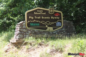
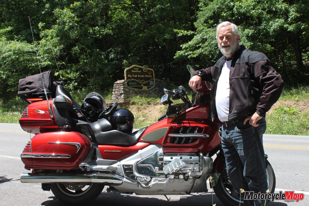
On our way to the Pig Trail Scenic Byway, we pass through the village of Lone Star. Carroll County gives way to Madison County, and we continue on through Huntsville, where we enter the Ozark National Forest. Legend has it that the Pig Trail owes its name to the paths wild pigs carved through these thick forests, which were later used as trails, and eventually became roads.
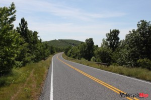
 In Franklin County, just before the tiny hamlet of Cass, we cross Mulberry River as it winds its way towards the mighty Arkansas River and eventually to the Mississippi. The Pig Trail is everything I thought it would be; a warning sign states, “Very Crooked and Steep Next 3 Miles.” Corner advisory speeds are well posted, and although I tend to challenge these, I learn that it is wise to slow down. Up ahead, a waiting ambulance and police car justifies my caution. Beside a tight 180-degree, 10 mph corner, and deep into the bush, I can see a cruiser-style motorcycle resting against a tree. Its rider is being carried up the steep hill on a stretcher. I hope all that is damaged is his pride.
Hidden in the trees high above us is the Ozark Highlands Trail, a hiking trail that runs for 180 miles through seven counties in northwest Arkansas. We curve right and plunge downward into a hairpin curve followed by another hairpin, and climb upward through an opening in the forest. Suddenly a lake appears, in yet another beautiful green valley, surrounding a farmhouse and barns. This type of scene repeats itself over and over, with splendid variations. Leaving the Boston Mountains, which are the southern gate to the Ozark National Forest, we cross I-40 and stop for a quick lunch in the town of Ozark.
 Stepping out of the air-conditioned restaurant, we begin to wilt in the heat as we head south on AR 309 to the Mount Magazine Scenic Byway. I am now convinced that any road you take in Arkansas is a great biking road. Winding through the forest, the road clings to the edge of the limestone cliffs as I catch sporadic views of the valleys and towns below us. At a height of 840 metres, we welcome the cooler temperature on Mount Magazine as we gain elevation and stop for a view at one of the many pullovers. I understand now why the locals say, “It’s not that the mountains are so high, it’s that the valleys are so deep.”
It is midweek in late May, and this leaves us pretty much to ourselves on these roads. Of course, this all changes on the weekends, when bikers arrive in droves to experience Arkansas’s offerings.
We descend into the lowlands south of Mt. Magazine, bringing us to Havana. At Ola, we catch Scenic Highway 7, riding south to Hot Springs. As we roll into Hot Springs, we pass 1011 Park Avenue, the boyhood home of William Jefferson Clinton (aka Slick Willie, aka President Bill Clinton). On Central Avenue, we pass by the elegant old Arlington Hotel, which was Al Capone’s favourite place to stay, among many other gangsters over the years. Lined with magnificent magnolia trees, Main Street is famous for its many Gothic-designed bathhouses. Further along is the stupendous Oaklawn Jockey Club. Operating since 1904, Oaklawn is the oldest family-run horse track in America.
Later, at Hot Springs National Park, a ranger tells us that the water is 140 degrees Fahrenheit when it leaves the ground, and at the pools below, the temperature is still 114 degrees. A green algae growing under the water only grows at one other spring in North America, Radium Hot Springs in British Columbia. Each of the many bathhouses have their own hot springs gurgling forth from the mountain backdrop. Morning comes, and as we slowly ride along Central Avenue and Bathhouse Row, I make a silent vow to myself to learn more of the mystique and history of this ancient place named Manataka. We catch AR 227, a back route through the Ouachita hills that takes us to an old gas station and restaurant in a tiny hamlet called Story. We then head west to Pine Ridge, where I suddenly spot a familiar sign on the front of an old weather-beaten wooden building with a rusting corrugated steel roof. We spin around and go back, park the bikes in the gravel lot and walk into the Lum and Abner Jot ’Em Down Store and Museum. Before television, Lum and Abner were a radio comedy team much like Amos and Andy or Abbott and Costello. Jot ’Em Down was a popular name for general stores years ago, as clerks used to jot down customers’ purchase requests and then retrieve the items. Also in the store is a U.S. Post Office, which opened in 1888 and is still in operation. The citizens of Pine Ridge provided content for many of the comedy routines that Lum and Abner used throughout their careers, which spanned from 1931 to the 1950s. Moving on along AR 88, we pass through Mena and enter the Ouachita National Forest.
As we take a break at the entrance to the Talimena Scenic Drive, I hear a rustling and a snort in the forest and a deer leaps through the undergrowth, no doubt startled by our arrival. The Talimena follows the ridge of the Ouachita Mountains for 54 miles from Mena, Arkansas, to Talihina, Oklahoma, (Talimena combines the names of the towns at either end of the drive, Talihina and Mena). Perhaps the most scenic of all the drives through the Ozarks and Ouachita Mountains, this road was intentionally built to capture the beauty of the Rich Mountains and the Winding Stair Mountains. Be aware that upon crossing the state line, the road surface in Oklahoma changes to pea gravel and tar for about 10 miles. In the little western-type town of Talihina, we find Pam’s Hateful Hussy Diner. A small unassuming sign above the door does nothing to enhance the place, and inside it appears large and warehouse-like. Wainscoting made of corrugated steel panels and concrete floors are the decor. Our server arrives and I ask her where the Hateful Hussy is. She whispers, “You mean little Hitler – she’s in the kitchen right now.” It’s not too long before the Hateful Hussy appears, noisily straightening chairs and tables as she calls out orders to her staff. Pam, the Hateful Hussy, lives up to her name, and we find it all quite humorous. Heading north out of Tailihina, we swoop left and right on the high-speed bends leading into the Winding Stair Mountains on our way toward Fort Smith, the town that the movie True Grit is centred around. Checking into a hotel, we find ourselves between the police station and the courthouse. Our bikes have never been safer for overnight parking. Fort Smith was geographically on the edge of hell for nearly 80 years before and after the Civil War.
On the Arkansas River, it was the gateway for the American move westward, through which supplies flowed for western expansion. The Trail of Tears — the devastating path traversed by the Cherokee Nation — moved through Fort Smith to the new Cherokee territory in Oklahoma. This ill-gotten move caused many battles between the indigenous tribes, and in turn provided a haven for every cattle thief, rapist or murderer of the day. This changed under the appointment of Judge Isaac C. Parker, “The Hangin’ Judge,” of the Federal Court of the Western District of Arkansas. From 1875 to 1896, Judge Parker heard over 13,000 cases, of which 344 were capital offences. Of these, 160 convicts were sentenced to be hanged, and 79 actually “stretched the hemp,” as described by the local newspapers. Approaching Judge Parker’s Court in the Fort Smith National Historic Site, the first thing that comes into view is the gallows. Not just any gallows, this reproduction of the original 1886 gallows was set up to hang several people with a single trapdoor. History records that on numerous occasions, several criminals at once took the six-foot drop to meet their maker with a single pull of the handle. A short walk brings us to the building that housed the barracks, courthouse and jail.
Directly under the courthouse, the jail provided the most rudimentary necessities of life: a straw tick mattress on a stone floor, stone walls and two fireplaces. Judge Parker was instrumental in designing a new, more modern prison, but this jail was commonly referred to as “Hell on the border.” Leaving Judge Parker’s courthouse, a sounding bell draws our attention to an operating antique electric trolley pulling up to its stop and dropping off passengers. Built in 1926, Old Number 224 is the only one of its kind to survive, and has been restored to its original condition. It pulls up and stops at the Fort Smith Museum of History. The driver reveals to me that his great-great-uncle operated this same trolley when it was new. Regrettably, we depart Fort Smith knowing there is much more to see, and we head east to Clarksville, then to Lamar and the much-touted and demanding AR 123. Running north out of town, the rolling hills and open fields soon give way to the many twists and turns we have come to expect in this state of grand roads. We terrace upwards on more crooked roads into the asphalt labyrinth called the Boston Mountains. Our blood begins to move more rapidly as we bank hard into the luxurious corners afforded to us most abundantly by the path-pavers of yesteryear. In the heart of the Ozark National Forest once again, we ride through Fort Douglas and Dillen on this glorious route north from Lamar to Sand Gap. It is a phenomenal piece of road that will either test your skills, or allow you to simply lie back and enjoy this golden ride to the fullest. At AR 7 Scenic Byway we take a break.
A total of two logging trucks and three cars go by in a span of about 15 minutes, and I think to myself just how perfect this is. Mounting up for the ride on Scenic 7, we pass by the Cliff House Restaurant on Lookout Mountain. Overlooking the Arkansas Grand Canyon, I’ve been told that some of the most majestic sunrises in Arkansas are viewed from here. Later in the year, when the days are cooler, elk are frequently seen in the valley below. Between Jasper and Harrison we pass by Dogpatch, the most miserable town in America, according to the old comic strip Li’l Abner. Now a ghost town, it was once to be a 1000-acre development. It closed in 1996 and fell into disrepair. The name has been changed to Marble Falls after much petitioning by the locals, but many maps still have Dogpatch on them. Just north of Harrison, AR 65 takes us to AR 62, and soon we are climbing the narrow, 45-degree Howell Avenue in Eureka Springs, finally arriving at the 1886 Crescent Hotel and Spa. It’s been an exciting couple of days with more to come . . . but that’s another story.


