In the distance, giant fir trees pierce the early morning mist as I load my saddlebags. To begin my two-day adventure through the Cascade Mountains of Washington State, a brand-new Triumph Tiger 800XC awaits me in Langley, British Columbia, compliments of Triumph and Western Powersports.
Once on the Trans-Canada super slab, I hightail it to Abbotsford. Even though this is a dual-sport type of bike, it adapts well to high-speed highway riding and hums along contentedly at – oops – better slow that down a bit. I head south a few blocks to United States Customs at the Abbotsford/Sumas crossing, and I am soon loping along Washington’s fertile flatlands on Highway WA 9. Skirting the foothills, still hidden by the mist, I try to identify the different farm crops. These fertile lands produce many crop variations, from grains for the many dairy farms, to grapes that supply the local wineries. With the Pacific Ocean just a few miles to the west, there are even farms producing oysters, clams and mussels.
The Tiger, with its unique, triple-cylinder exhaust note, breaks the morning quiet with a pleasant burbling resonance, providing music to my ears as my mind wanders to the legends of Bigfoot. I wonder what lurks deep within those forested, mist-covered mountains. Will I join the ranks of believers who say they have seen Bigfoot? My camera is always at the ready should that rarest of moments present itself.
 Following the Nooksack River through Nooksack and Deming, I arrive at a village called Acme, and I immediately think of Wile E. Coyote with his Acme suitcase of nasty tricks, in never-ending pursuit of the elusive Roadrunner.
About 65 km later, WA 9 terminates at Sedro-Woolley. Amalgamated from the rival towns of Sedro and Woolley, the name Sedro comes from the Spanish “cedro” meaning cedar, and “Woolley” was the name of a railroad developer and prominent businessman who lived here at the turn of the twentieth century. This verdant valley, with its trim farmhouses and red barns, comes alive each March in a kaleidoscope of variegated blooms. Appropriately, this is home to the largest commercial flower bulb industry in the world outside of Holland.
A left in Sedro-Woolley puts me on WA 20 east, my starting point for the phenomenal Cascade Loop Ride. Gentle sweeping curves lead me into the mountains, where the highway and the Skagit River unite and follow the valley eastward. At Hurn Field, I stop at a viewing area for elk and other wildlife. This 26-hectare parcel of land along the Skagit River was set aside, unspoiled and protected by conservationists. After scanning a scene at that moment devoid of wildlife, I mount up and move on.
With light clouds floating amidst the mountaintops, I opt for Dalles Road, a parallel route that runs directly beside the Skagit River. I cannot help coveting the homes along these picturesque shores. This river is a fisherman’s paradise, filled with a wide variety of salmon and trout. Originating between Hope and Princeton in the Canadian Cascade’s Allison Pass, the Skagit River flows through B.C.’s Crowsnest Pass and Manning Provincial Park on its way south into Washington State, where it meanders southeast, quietly emptying into the mighty Pacific at Puget Sound. I would love to be here during spring runoff to see the tumultuous side of her personality.
Around the next corner is Concrete, a town with a rather uninviting name. It looms large with its two bunker-like cement silos emblazoned with a sign, “Welcome to Concrete.” Originally named Minnehaha and then Baker, it later merged with the town across the river, and the name Concrete was adopted because of the Superior Portland Cement Company, which built a plant there. I like Minnehaha better.
 A bit farther along, as I crest a hill, another Kodak moment presents itself. I stop on the sloping shoulder and put the side stand down. Deciding that I should change my position, I make the mistake of sitting back on the saddle; the suspension compresses, the side stand hits the ground, and the bike launches to the downhill side. By the time my foot finds terra firma on the low side, it’s too late to stop the Tiger’s gathering inertia as it descends to mother earth. On my backside, about 10 feet away from the Triumph, I audibly vocalize my dissatisfaction with my own stupidity. As I get up and dust myself off, I remember that most motorcycle accidents happen when the bike is stopped. And I keep the tradition alive. With minimal damage and no witnesses to my embarrassment, I quickly right the Tiger and toddle off down the highway, my only injury a severely bruised ego. Always a quick healer, I soon make a full recovery and my smile returns, as I realize again that accidents happen because of people, not bikes.
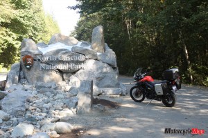
I stop at an overview at Rockport, population 109. Located on a bend in the river, Rockport is a postcard-perfect village, with the river on one side and towering mountains on the other. Just up the road at Marblemount, a sign tells me that it’s 68 miles (109 km) to the next services, so I wisely stop and fill up. Inside the North Cascades National Park, I stop at Gorge Dam, the first of three hydroelectric dams on the Skagit. An overlook provides a view of the headwater, Gorge Creek, and a small waterfall tumbling into the river far below.
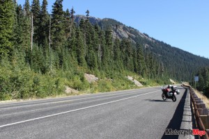
Higher and higher I climb, as the trees become scrubby and the mountains more rugged. Snow on the northern sides of the craggy mountaintops is a sign of my altitude, and with the deliberate precision that the Tiger offers, I carefully negotiate the narrow road cut into the cliff, overlooking the gorge and river far below.
The second in the three-dam trilogy is the Diablo Dam, just off Hwy 20. Constructed between 1927 and 1929, the Diablo Dam is 396 m long, 118 m high and 40 m thick. I ride across the arched dam, and the panorama of the lake surrounded by mountains is phenomenal. I make my way back to the highway and terrace upward to a scenic overlook where I can see as far as Canada to my right, Diablo Lake in front, and snow-capped mountains all around. The view is spectacular!
I continue to ascend along WA 20 following the Skagit River. As I pass Ross Lake and the third dam, which bears its name, I can feel my eardrums adjusting. I breeze by a large highway gate where the speed limit changes to 60 mph (97 km/h). In the winter months, avalanches are a constant threat from the Diablo Dam to Mazama, Washington, a distance of about 80 km (50 miles), so this part of WA 20 closes from mid-November to late April for the safety of motorists and road workers. The trees here are dwarfed because of the altitude, and jagged peaks with glaciers hugging their steep, rock-strewn slopes give the area a moonscape appearance.
High atop Rainy Pass, at 1486 m (4875 ft.) elevation, I am still climbing, and in a few minutes I turn into a scenic overlook at Washington Pass at 1669 m (5477 ft.) elevation. Dismounting, I clamber up and over the house-sized rocks to another overlook. Standing on the edge of the sheer cliff, there is nothing between me and disaster. Far below, diminutive cars creep along a winding black strip. I sit and rest, with feet dangling over the precipice, as I listen to my elevated heart rate and savour the peaceful moments while the breeze eerily whispers through the bows of the scantily clad firs.
Slowly idling downward, I soon bid farewell to the North Cascades National Park and enter the Methow Valley, which offers a dramatic change in scenery and environment. The jagged peaks and glaciers are replaced by brown, arid, desert mountains along the Methow River. Here and there, where irrigation provides the missing ingredient, the brown valley floor abruptly explodes into a sea of vivid green, revealing the fertility of the area. Winthrop, the eastern gateway to the North Cascades National Park, is located at the confluence of the Methow and Chewuch Rivers, where fly-fishing is the main draw. Winthrop’s false storefronts, hitching rails and boardwalks create the illusion of a frontier town, and I feel like I’ve just ridden into a western movie set. Across the bridge at the far end of town, I arrive at my digs for the night, the unique Mount Gardner Inn.
Proudly displaying its western theme, the log furniture in the exceptionally clean and tidy rooms completes the motif. And as I unpack, a deer grazes on the lawn just a few feet from my window. Dinner on the patio of the Duck Brand Restaurant and a stroll around town finishes my day. Awakened early, I attempt to clean the dew off my seat only to find that it is actually frost, and I’m happy I brought warm clothing. I exit town in the pre-dawn chill. Still in town, a buck startles me as he stands in the middle of the road and stares me down before quietly walking off the roadway. The valley is peaceful, quiet and cold as I snake southward following the Methow River. At Twisp, I spot three deer fording the river and stop for a few minutes to watch and warm my fingers. Highway WA 20 twists upward as I head into the mountains of the Okanogan National Forest. It is a sensational ride through this forest, where the charred sentinels of once-vibrant firs still stand as ghostly reminders of past forest fires. Just before the town of Okanogan, I stop high above the Okanogan River Valley at the site of the 1903 Curtis sheep slaughter.
Over a century ago, cattlemen, who had free-range grazing rights, felt encroached upon by sheep farmers moving into the area. Tempers flared and here, on a dark night in the spring of 1903, cattlemen slaughtered hundreds of sheep with clubs. The sun-bleached bones of the sheep remained for decades after the disputes were forgotten. Turning south on WA 97, I follow the meandering Okanogan River and some of the 800-mile Cariboo Trail (1287 km). An original Indian trail, it was used by Hudson’s Bay fur traders, gold rush prospectors and cattle drivers to feed the hungry miners in British Columbia. Where the Okanogan River dumps into Lake Pateros, I see a mist hanging over the valley, but by the time I get to Brewster, it has a smoky smell to it. A brush fire has been burning for a few months, and from here on I see and smell the smoke settling in the valleys.
Lake Pateros and Lake Entiat mark the beginnings of the mighty Columbia River. Apple and cherry orchards cover the shores back to the brown, arid hills. Set against a backdrop of sagebrush-blanketed hills, Lake Chelan, fed by runoff from the North Cascades National Park, dumps into the Columbia River. At 453 m (1486 ft.) deep, Lake Chelan is the third-deepest U.S. lake, and a popular tourist destination. The smoke on the water from the nearby fires gives the valley a surreal feeling, but here the Columbia is calm and quiet, perfectly reflecting the mountains in the background. With the sun shining, the temperature is comfortable, but my belly is empty. I turn off WA 97 and follow WA 2 west, the Cascades Loop’s southern arm. At Leavenworth, a Swiss-style welcome sign is an indicator of a pristine, immaculate town where every business front is styled in an Austrian motif. I turn down a street into the town centre and park the Triumph at the Tumwater Restaurant, the oldest restaurant in Leavenworth.
Greeted by a beautiful waitress who looks like Heidi, I ask “Sprechen zie Deutsche”? She says, “Nein, I’m from California.” Sometimes I just shouldn’t ask questions. Soon a plate filled with a Belgian waffle, edged with whipped cream, and smothered in thick blueberry sauce fills my void. With many miles to go, I leave town, and the reds and browns of the turning foliage along the street enthrall me. I expectantly round a curve and am confronted with the raw, majestic beauty of nature’s canvas. Slowly, I glide to a stop at the edge of the road to take in my surroundings. I have travelled to many places, but this ranks highly for absolute unadulterated natural beauty. Sitting on the guardrail with a steep cliff behind me and the Wenatchee River gurgling over the rocks below, I experience another unforgettable moment in time. Slowly, I wind through the canyon trying to see everything without riding into the ditch or the river. Thoroughly enjoying the views and the curvy road that the Tiger handles with ease, and with plenty of power on tap I hardly notice that I’m gaining altitude. The greens changing to hues of orange and red seem to flow down the mountainsides. Bright yellow flowers adorn the roadsides, and I arrive at Steven’s Pass, 43 km (27 miles) from Leavenworth and the highest point before I begin my descent into the Skykomish Valley.
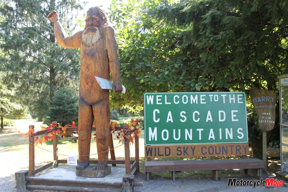
Threading my way down the gently winding road, I follow the Snohomish River and view yet another spectacular waterfall cascading down a distant mountainside. Finally after two days of riding I see it, in my peripheral vision – a blur in the forest. Could it be Bigfoot? Will I be that fortunate – or maybe unfortunate, if I don’t keep a safe distance. Cautiously I search the road for traffic and wheel around, heading back, and there it is, my firsthand look at a Bigfoot. I quietly get my camera out and my lens is filled with the monster. My mission is now complete. A photo of a ten-foot, hand-carved wooden Bigfoot: photographic proof that I am at the location where Harry and the Hendersons was filmed. All too soon I enter civilization again, and ploughing on, I finally reach Everett on I-5. From here it’s a straight run north to Bellingham, where WA 52 takes me over to WA 9 again and back to the same border crossing at Sumas. It’s been a 9-hour ride, plus time for stops, and the Tiger has proven to be a comfortable and pleasant motorcycle over the long haul. All that remains is an explanation for the two scratches I left on the saddlebag trim. As it turns out, my benefactors at Triumph and Western Powersports are gracious and understanding.


