A Land of Winding Rivers and Twisting Roads
From my vantage point, overlooking Idaho’s Payette Lake, I gazed north across the water at the rugged wilderness I was about to ride through.
The late-August sunshine, serenity and warm breezes were almost enough to lure me into hanging around, but a float plane passing overhead roused me from my reverie. Already awed by the roads and scenery in Idaho, I was about to head deeper into its northern beauty.
Now four weeks into a six-week solo motorcycle journey in the northwestern United States, I’d travelled north from Boise and stopped for a day in the small town of McCall. Originally a logging community, it’s now an all-season tourist destination with restaurants, galleries and boutique shops. Surrounded by mountains, the community bustles year-round with skiers, hikers, hunters, ATVers – and motorcyclists.
Historic Hotel McCall, where I stayed, is the focal point of the charming downtown. This bed and breakfast-style inn on the lake’s south shore has welcomed travellers from far and near since 1904. Rupert’s, the on-site dining room, boasts delicious cuisine, with much of it drawn from local resources. Of course, there’s a motorcycle-only parking area.
Hot Spot
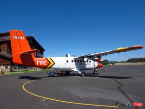 But don’t let the surrounding calm and beauty lull you into complacency. Nature can also be wild and fierce. Every year, an average of 1000 fires ignite in the six surrounding national forests, a fact brought home by the smoke visible in the air. Strategically located in their midst, the McCall Smokejumper Base, established in 1943, provides firefighting support to the western United States and Alaska.
It’s well worth making time for one of the twice-daily public tours of the base and a fascinating glimpse into its operations. Smokejumpers are an elite team of carefully selected men and women, specially trained as early responders to forest fires. Parachuted into remote areas with minimal supplies, they need to survive in the woods for 14-day rotations while performing extremely strenuous and hazardous work. While I was there, a DC3 landed, refuelled, recharged with fire suppressant and took off again within 30 minutes. The sky was never quiet. Twin Otters, DC3s and a Type 1 helicopter shuttled supplies, suppressant and equipment to numerous active fires.
Temperatures were climbing and I wanted to get on the road so I could stop by mid-afternoon and get out of the heat. My destination for the day was Kamiah (pronounced ka-mee-eye), 206 kilometres north of McCall. Not a great distance, but you can’t help but stop in awe to take in the natural beauty, and that adds travel time.
The route north on Highway 95 takes you between canyons and onto rolling prairie plateaus, fields of wheat and canola, and black fallow sections. You’ll see Tolo Lake, where the remains of several woolly mammoths have been found, and where the Nez Perce held tribal ceremonies.
I’d been invited to spend the weekend with friends Greer Stewart, Joley Baker and Kristine Ash, who were visiting the area from their homes on Vancouver Island, B.C. Inseparable from Kristine was six-year-old Tessie, her Yorkshire terrier, which was only too happy to don her gear (ATGATT) and take her place in Kristine’s tank bag.
It’s easy to stretch out those scenic stops, so the ride took longer than expected and it was five o’clock when I met them in Kamiah. After picking up a few supplies, we headed out of town for a few kilometres, capping off the day with a challenging climb to a mountain ridge home. Switchbacks, loose gravel and erosion ruts added interest to the 500-metre-long driveway, especially after a long day out in the heat. But every inch of that climb to the level landing at the top was worth it.
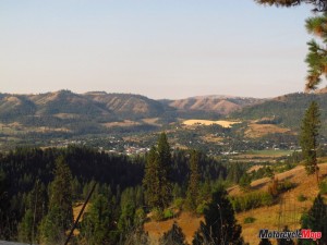
Removing my helmet, jacket and gloves, I walked over to the edge of the yard. Kamiah Valley opened below me, nestled along the Clearwater River between the Rockies and Bitterroot Mountains. This would be home base for the next few days while we visited and explored the mountain wilderness.
Lewis and Clark
Originating before records were kept, Kamiah was the winter ancestral home of the Nez Perce Indians. In May 1806, explorers Meriwether Lewis and William Clark camped here, waiting for the snow to melt so they could continue their journey back east. Over 200 years later, we’d be riding the same route by motorcycle, albeit under sunny skies, in hot temperatures and on a paved road.
 When Thomas Jefferson commissioned Lewis and Clark to find the Northwest Passage in 1803, little did he know they would pave the way for motorcyclists to wind their way through the same wilderness. Mandated to find the link between the Missouri and Columbia Rivers, Lewis and Clark’s route brought them west along the beautiful Lochsa (pronounced lock-saw) and Clearwater Rivers. Their trail along the mountain ridge is slightly above where the road now hugs the waterway.
Highway 12 forms the Northwest Passage Scenic Byway, Idaho’s longest Scenic Byway, and the longest highway within a national forest. It winds 325 picturesque kilometres across the state, starting close to the Oregon border at Lewiston and ending at Lolo Pass and the border with Montana. We were joining the byway in Kamiah, 105 kilometres east of Lewiston. An interpretive kiosk in the Kamiah City Park beside the bridge offers an intriguing history of the area.
The road south from Kamiah follows the transparent Clearwater River, staying with it as it veers east at Kooskia (pronounced koos-kee) at the confluence of the Clearwater’s south and middle forks. That’s where the fun and 160 kilometres of uninterrupted curves through the Bitterroot Mountains really start, en route to the Lochsa Canyon.
As with any remote travel, it’s wise to fuel up when the opportunity arises, as it may be a while to the next stop. Remember to have plenty of drinking water on board as well. I learned not to rely on the signs or map markings that promise services at a particular location. It wasn’t unusual to arrive and find the establishment closed or not having high-octane gas.
Cool Rivers and Hot Springs
 Straight stretches, sweeping curves and magnificent vistas along the rugged riverbanks are the norm. It’s mesmerizing and consequently a wise idea to stop every now and then at one of the frequent pull-off spots to take in the surroundings, where you’ll inevitably be joined by other riders and end up swapping adventure stories.
It was at one of these spots that we met the “Albertans” – a couple on their honeymoon, along with two of the husband’s brothers. The brothers lived distances apart and this annual ride was their opportunity to spend time together. They were at the halfway point of their trip and having a grand time, full of good-natured kidding and brotherly banter.
Gearing up and taking off, we were soon back into the rhythm of the road, swooping and turning as osprey and bald eagles soared above us. Colourful rafts ferried friends idyllically down the river, which is tranquil this time of the year. Even though it was a Saturday, there were few vehicles to share the road with, and even then, most were motorcycles.
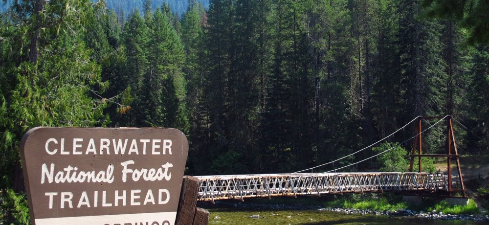
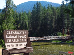
The volcanic activity that created these mountains resulted in the formation of hot springs, some within easy walking distance of the road. Warm Springs offers a short walk from a small gravel parking lot, across a picturesque bridge to a marked trail that takes you to the springs. Even in hot weather, it’s a nice diversion.
Farther east, take in the DeVoto Memorial Cedar Grove, named for Bernard DeVoto, who edited the Lewis and Clark journals. Two short trails loop between massive and stately western red cedars in a grove offering sanctuary and shade, even in the heat of summer. Except for the sign, the wilderness transition was seamless as we entered the Lochsa National Forest and then followed the Lochsa River. If you enjoy camping, there are plenty of maintained campgrounds along this whole route, but camping is restricted to designated sites. You can also stop for a self-guided tour of the Lochsa Historical Ranger Station, built in the 1920s. The temperatures were in the mid-30s, even at relatively higher elevations, so it was a relief to arrive at Lolo Pass (elev. 1595 m) and the visitor’s centre, to cool off and water up. Always the centre of attention, Tessie was happy to stretch her little legs while we recharged.
You’ve Gone Far Enough
The “Welcome to Montana” road sign was visible from the driveway, but we’d gone far enough. It was time to backtrack and another 160 kilometres of winding road. On the way to Lolo Pass, we’d passed by Powell, which isn’t much more than a road sign and the Lochsa Lodge, a four-season wilderness oasis just off the road. We weren’t going to pass it on the way down. I’m always amazed to come upon these spots, in the middle of nowhere with a parking lot full of cars – and motorcycles. True, it’s the only game in town, but you’d never guess it from the service. Offering accommodations, a full-service dining room and camping, the food was tasty, prompt and healthful – with lots of choices. We chose to eat in the air-conditioned rustic and well-appointed dining room. A lovely deck overlooking the forest provided an alternative for a cooler day.
Gas, including premium, was available here as well. By the time we finished lunch it was mid-afternoon. But leaving among a crowd of riders is not so simple as putting on your gear, hopping on your bike and taking off. There are people to meet and stories to be heard – like the couple heading off-road for 150 kilometres, two-up. Or another couple we’d seen in the dining room: He’d returned for a roast beef sandwich, a lunch he and his sister and friends had planned for the previous year. She’d died a year earlier in an accident on the way there and he’d returned to have that sandwich in her memory. Finally, we fuelled up and headed back, along the same curves through the same soul-charging forests and riversides. Although the perspective was different, it was every bit as gorgeous. Satiated as we were with riding when we returned, I knew I’d be ready to go again after a meal and a night’s rest under a billion stars. I was continuing on my journey in the morning and travelling back along the same road, this time continuing on into Montana. I’d be leaving Idaho with wonderful memories and a plan to be back.


