
Utah’s Mighty 5


From vast expanses of desert to massive, jagged spires of red sandstone, Utah offers some of the most diverse riding in North America
The sign read Zion National Park. But the double-wide lineup of cars at the gate looked more like rush hour in Toronto. Utah had been promoting its national parks as “The Mighty 5,” and apparently I wasn’t the only one to have seen the ads. Summer attendance was up 30 per cent, and the campground was so full that, as I set up camp, a white SUV from Nevada pulled up and a slightly stressed-looking couple sheepishly asked if I would be willing to share. I gestured toward my bivy sack and Suzuki V-Strom DL650 and said, “I’m only using a quarter of the site; it seems a shame to waste it!” They offered to pay, and when I refused, they announced, “We’re having shish kebabs for dinner!” That I could not refuse.
It was still early afternoon, however, so while they set up their gear, I took the park shuttle into Zion Canyon. At the upper end of the canyon, a trail called The Narrows followed the Virgin River until the canyon narrowed and any riverbank disappeared. Then I waded in and began zigzagging my way up the twisting canyon in cool water that reached mid-thigh. Feeling my way over the rocky riverbed, I held my camera tightly and snapped photos of the 300-metre-high walls that crowded the ever-tapering river. When I returned to the campsite, Hector and Patty were busily getting a fire started and laying out the promised shish kebabs on the grill. It was a chance meeting that became a great meal and a wonderful evening of conversation.
Antelope Canyon
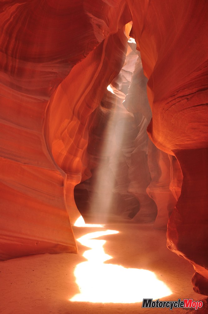
 The next morning, I was eager to tour beautiful Antelope Canyon, just over the state line in Page, Arizona. But the two-hour journey was destined for trouble. My first mistake was that I had forgotten to remove “Dirt Tracks” from Preferences on my GPS. My second mistake was staying too long at the gas bar, talking motorcycles with two riders from Tennessee. If I was going to make my 11 a.m. reservation, I was really going to have to cover some ground. So, while I was surprised when the GPS began to lead me up a gravel road, I happily assumed (my third mistake) that it had found a short cut. Gravel soon turned to dirt, and dirt soon turned to a river wash that was deeply rutted and sandy. In a bumping, twisting moment of grace, I was down. Time was short, so I made a deluded attempt to pick up the bike without unloading all the gear. Wasn’t this, after all, why I kept up a fitness program all winter? From a squat, my biceps, traps and quads strained in a mighty lift. The bike barely budged. Faith turned to cursing as I began to remove my tent, tarp, sleeping bag and luggage: Antelope Canyon was one of the anticipated highlights of my trip, and I was going to miss it! A couple in a 4×4 came bumping down the wash, warning me that it got even worse farther up. When they asked if I needed help, I heard a macho voice say, “No, I’ve got this.” (Who was that?!) The good news is I got the bike pointed downhill, then I reloaded and made it back to the highway with only a broken mirror. The better news is that I did not see an Officer of the Law for the supposed two-hour run that took only 80 minutes, courtesy of a wide-open throttle. The best news is I had forgotten that Arizona does not observe daylight saving time, so instead of entirely missing my tour, I arrived with five minutes to spare. Antelope Canyon was worth every bit of effort.
Bryce Canyon
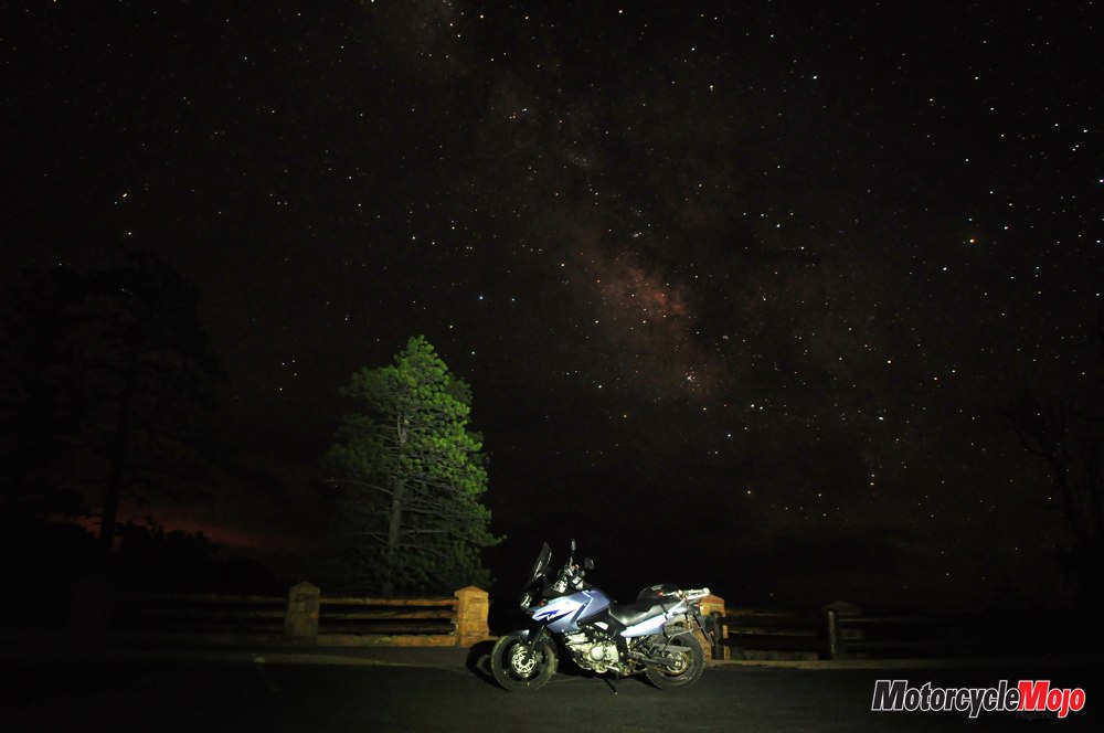
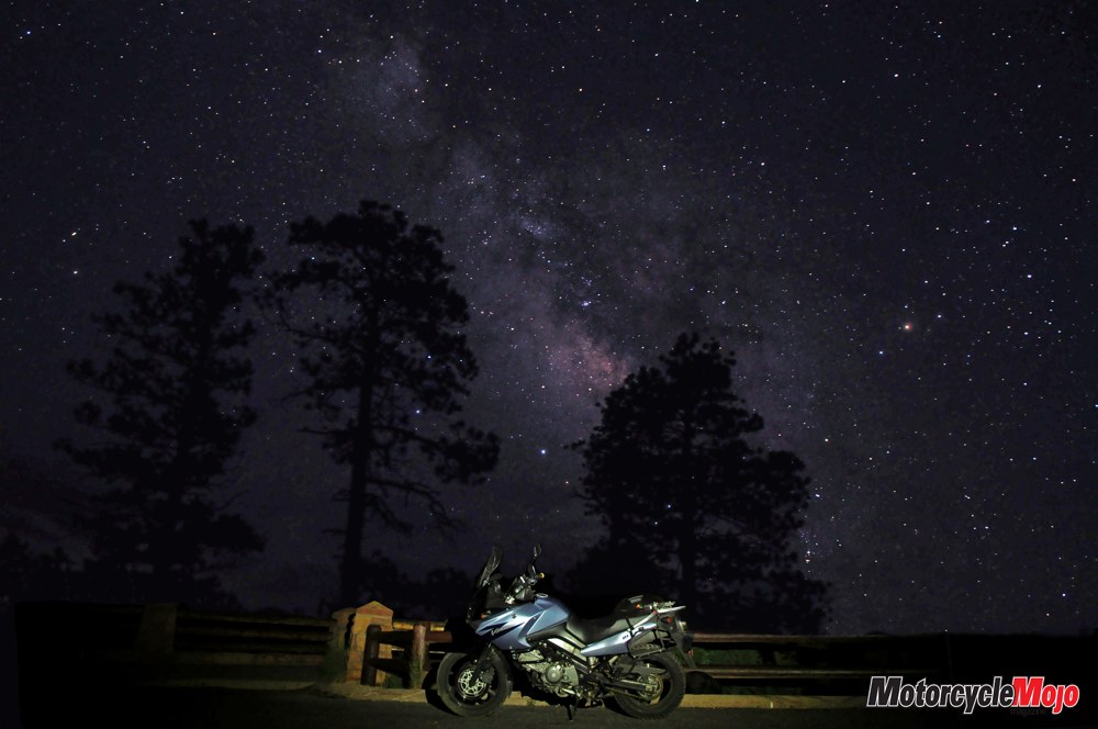
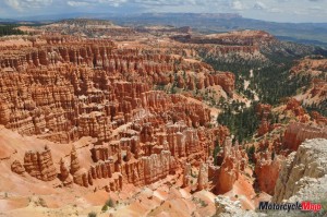 It was a much more leisurely ride to Bryce Canyon National Park for the night. Highway 89 leads north through beautiful green fields and meadows framed by red cliffs. Because I know the Utah desert offers some of the clearest night skies in North America, I had invested some time in learning a few techniques of star photography. I was eager to try capturing the colours of the Milky Way, and stayed up past midnight using a flashlight to “paint” items in the foreground, such as trees, cacti and a lovely blue V-Strom. I was delighted with the results.
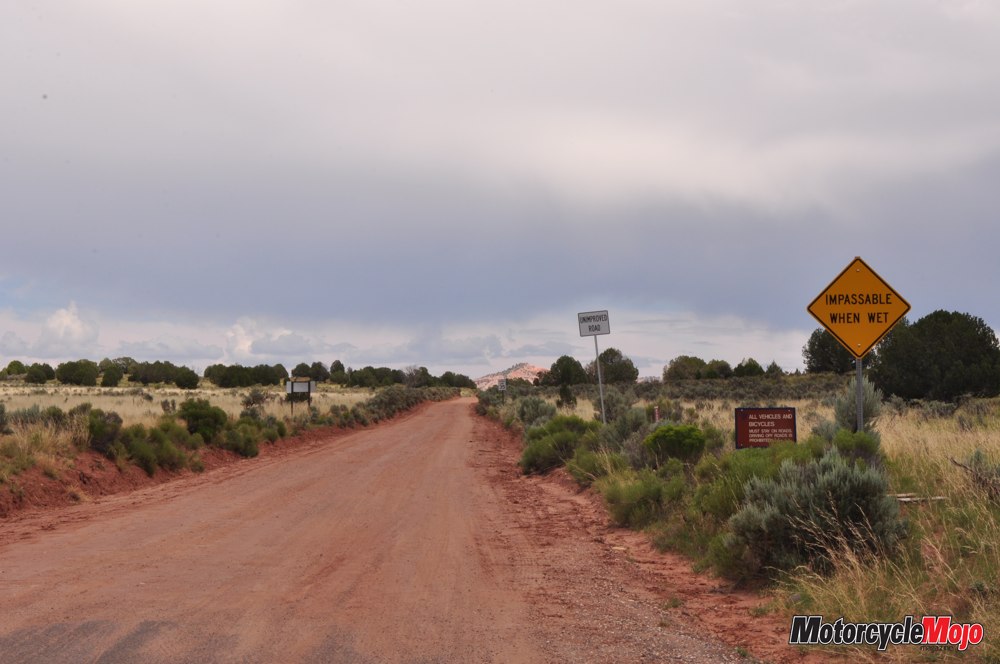
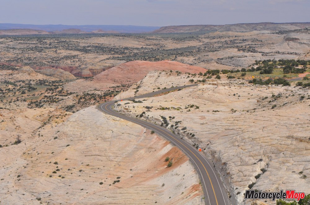
Scenic Byway 12, one of only 31 “All-American Roads,” leads through a corner of Grand Staircase-Escalante National Monument, a 1.9-million-acre tract of the most barren, wind-polished slickrock imaginable. In fact, this was the last area to be mapped in the entire continental United States. The town of Calf Creek was still receiving its mail by mule train in 1940. The highway was a project of the Civilian Conservation Corps during the Depression and was the result of five years of back-breaking labour with pick and shovel and tons of dynamite blasting through the cement-like terrain. One section of the narrow road runs along a high ridge with 70-degree drops on either side, allowing no margin for error – and providing confirmation that my adrenal glands are in good working order.
In Boulder, I stopped at Anasazi State Park Museum, where a look at the skies, and an emergency flash flood alert on my cellphone, gave me pause. The road ahead rose to 3,000 metres, where lightning and snow were real threats. Not in the mood to test the tires’ winter traction or my own conductivity, I got a room at the only hotel in town.
Capitol Reef
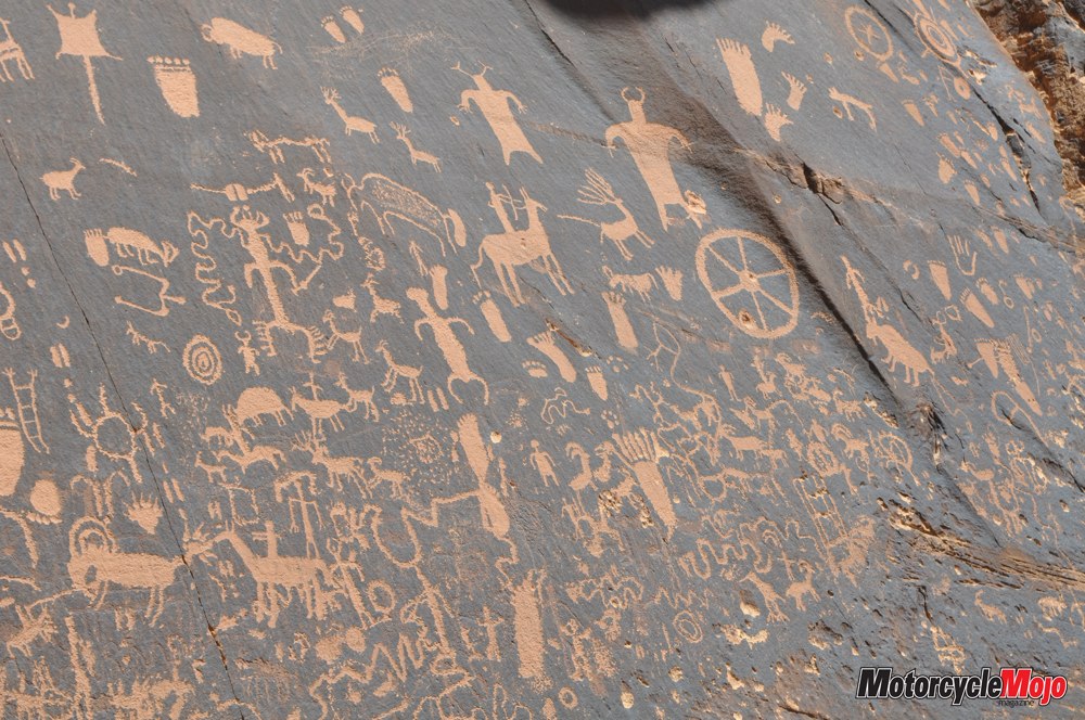
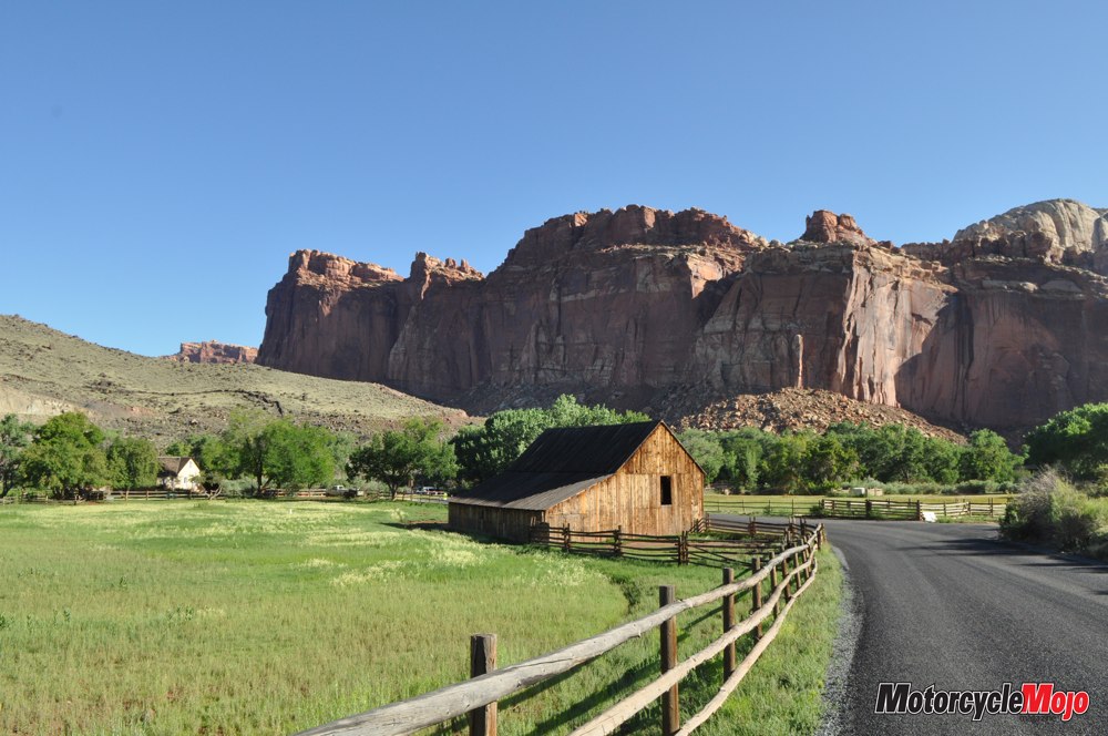
 In the early morning, Hwy 12 continued to be just as beautiful and varied as it was the previous day. Sagebrush, and then juniper and pinyon trees began to find soil, and soon I was riding through Dixie National Forest. Descending into Torrey, I came to Capitol Reef National Park, where a great buckle in the Earth’s crust stretches across 160 km of south-central Utah, trapping water, and hampering westward travel. In the early 1900s, the intensely green Fruita Valley became home to several Mormon pioneers. The Gifford family homesteaded here until 1969, when they sold their land to the National Park Service, which now maintains their home and barn, along with cherry, peach and apple orchards. I wanted to tour the backcountry loop and visit Pioneer Register, a rock wall covered in the signatures of westward travellers of the 1800s, but the storm the night before had caused flooding that washed out parts of the road. The Fremont River was still running high, red with silt.
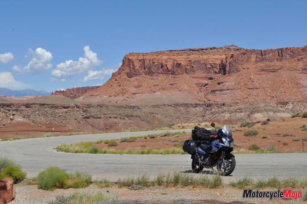
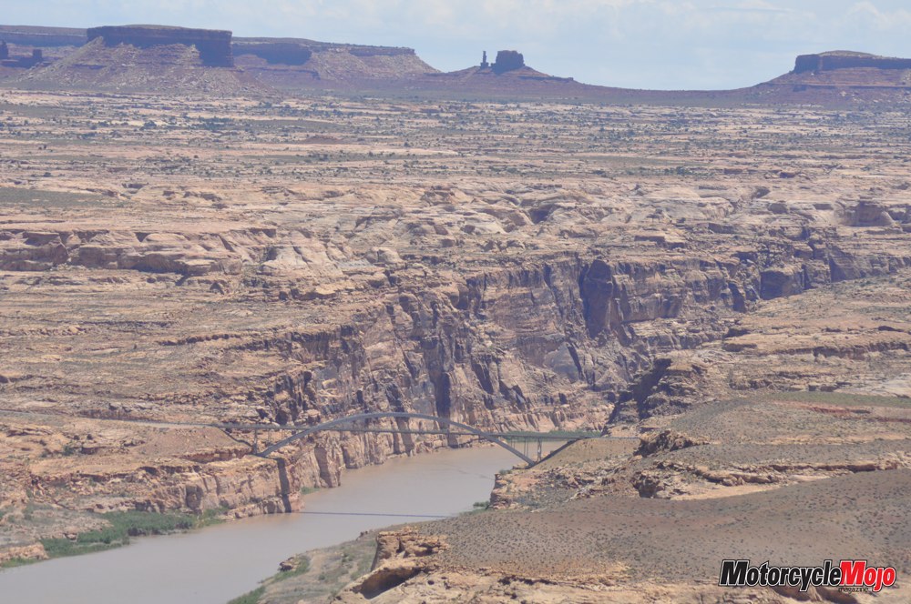
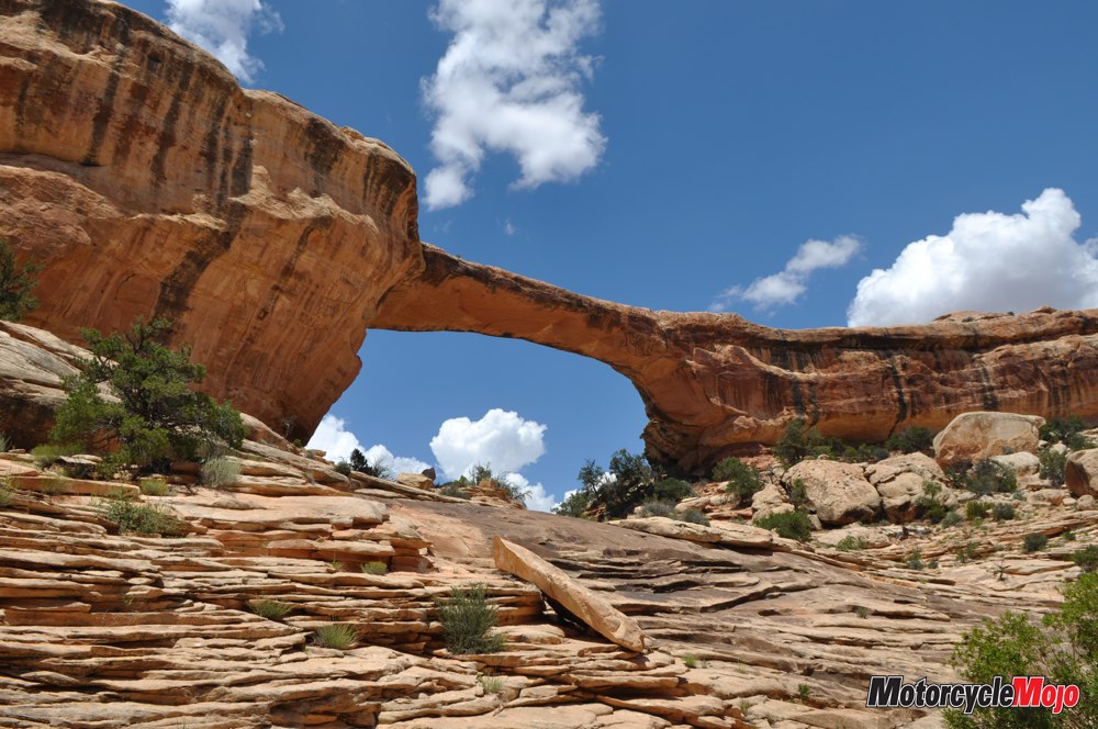
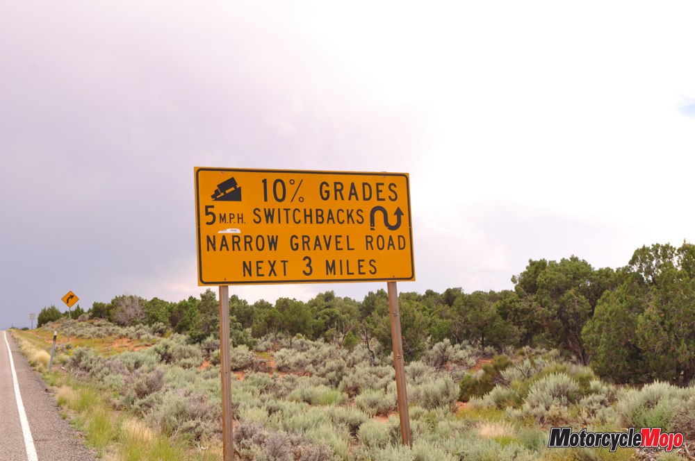
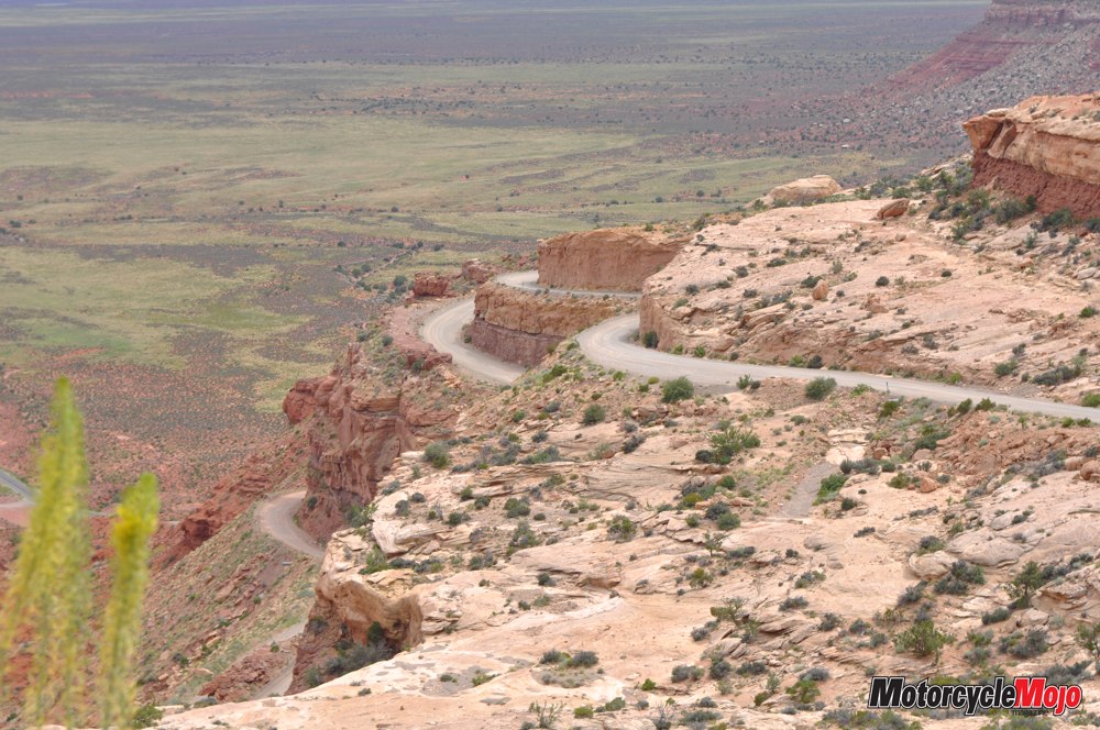
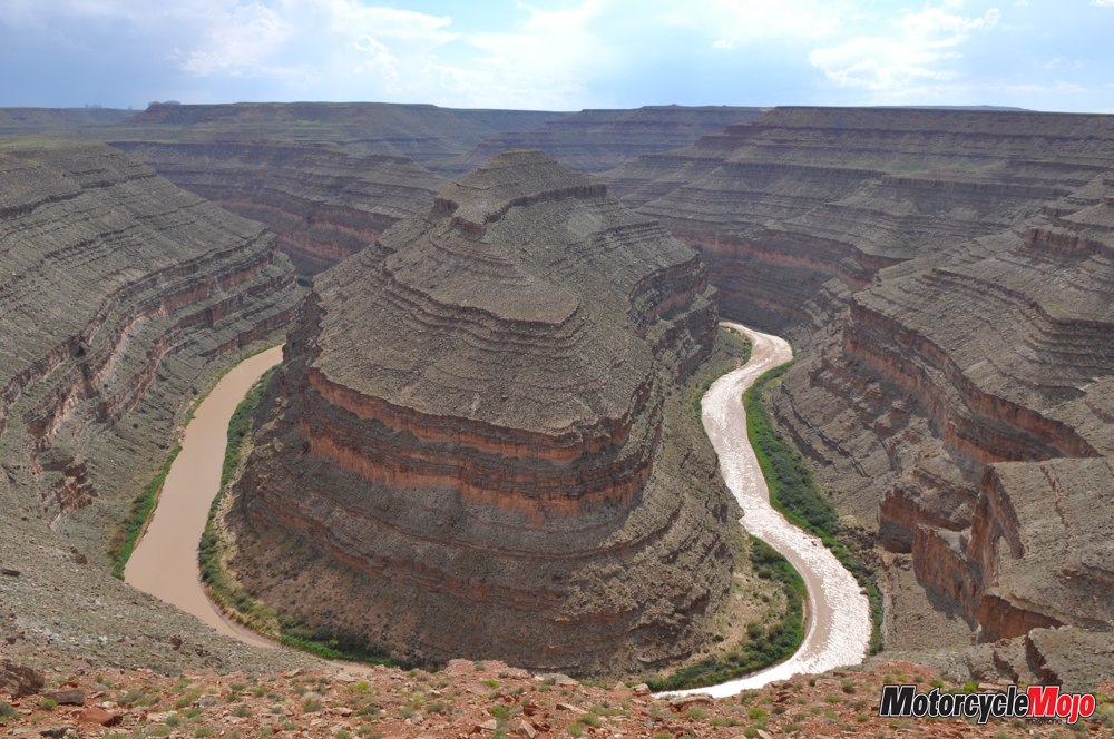
In Hanksville, a half-dozen BMW riders were taking advantage of the last available fuel stop for 363 km. After filling the Strom’s tank to the neck, I topped off an additional one-gallon jerry can I had brought for just such an occasion. The expanse was sparsely populated, but it was anything but dull. Moki Dugway Highway 95 south is a series of straightaways, sweepers and switchbacks, rising and falling, the road finding its way like a dark, winding river. Crossing the Dirty Devil and Colorado Rivers, I stopped to hike in Natural Bridges National Monument. From there it was a long, unremarkable stretch of ranchland, enough to lull one to sleep, until, like a gift from the travel gods (or the DOT), Moki Dugway suddenly appeared at the edge of 365-metre-high Cedar Mesa.
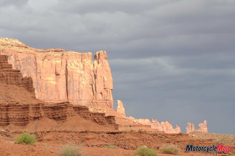
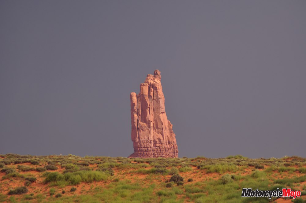
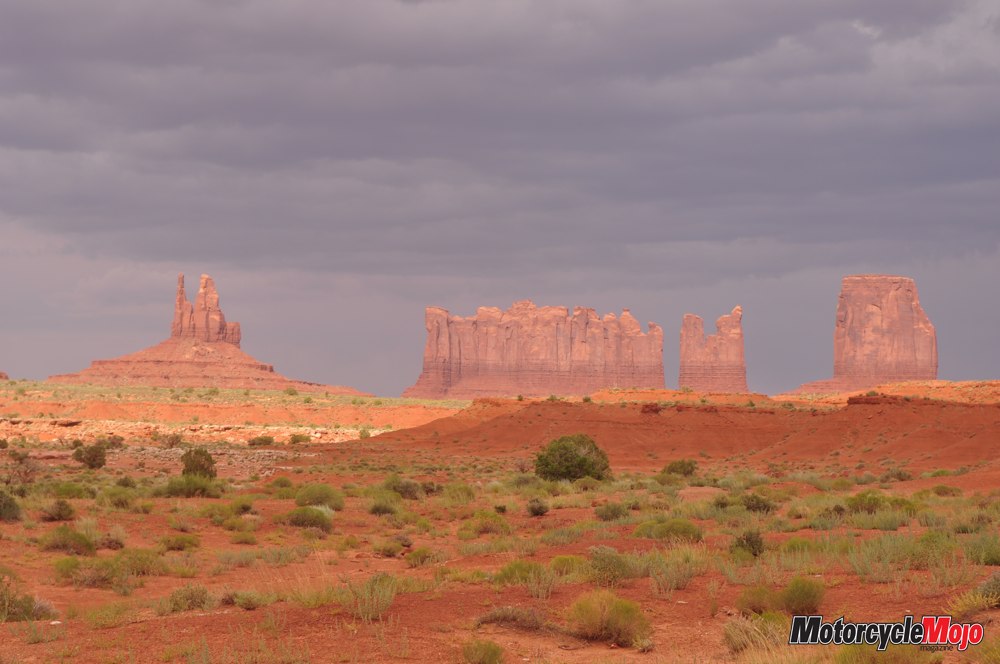
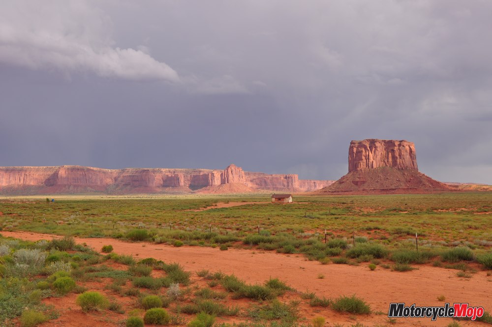
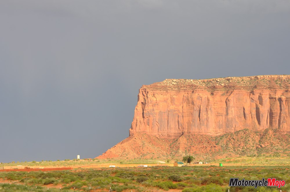
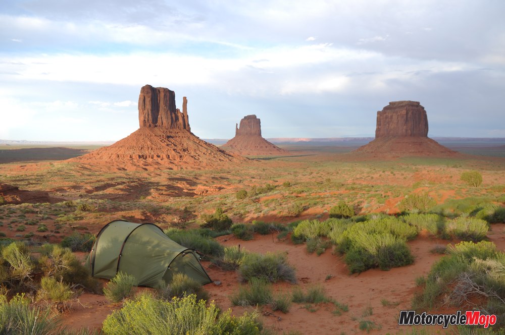
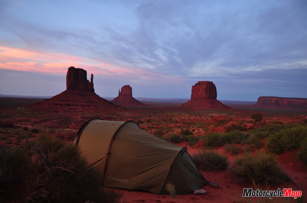
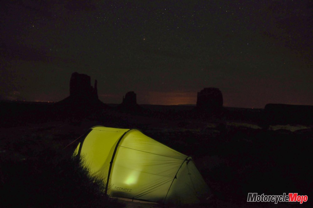
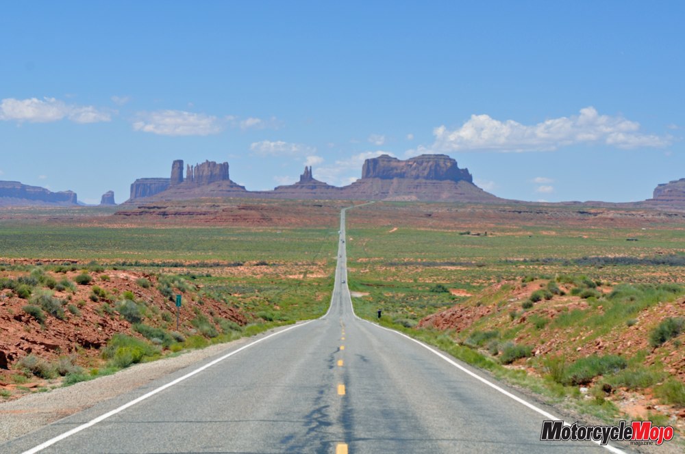
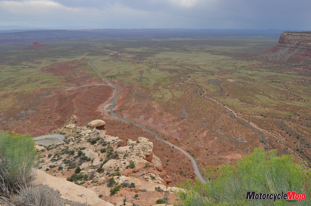
The Dugway is a gravel road – barely two lanes wide – with 10 per cent grade, multiple switchbacks and no guardrails. Looking down from the first several levels of the Dugway was like viewing the Earth from the window of a small plane. A tiny ribbon of road stretched into the distance where I could see Goosenecks State Park and even Monument Valley, Arizona – my next stops. If I made it to the bottom, in one piece. Passing through Valley of the Gods, I successfully threaded the needle between two equally powerful thunderstorms just as the sun broke through to spotlight the bright red buttes against the brooding purple skies. I had to wonder if nature cooperated like this for National Geographic. Setting up camp at Monument Valley Navajo Tribal Park was another matter. The wind was the most powerful of my entire trip.
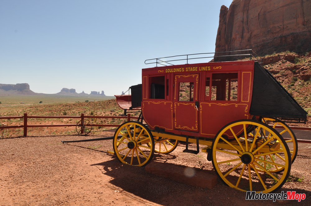
Gusts that had nearly blown me off the road now sandblasted me with red desert grit while I wrestled with a tent that snapped and popped in the wind. I was grateful for the calm that came with sunset. In the morning, I visited Gouldings, a tiny town across the highway where John Wayne had starred in several westerns. Then I headed back up Route 163, the iconic arrow-straight highway where Forrest Gump ended his famous run. Arriving in Moab later that day, I found the Lazy Lizard Hostel. For one-third the cost of camping in the local state park, I had a roof, a bed, laundry and – for a small donation – communal meals. Some of the guests were staying for the whole summer, working as trail guides and river-rafting pilots. It was a pleasure to meet these and other travellers, sharing our stories and travel tips well into the night. The Arches I awoke to the smell of pancakes and the sound of accordion music on the patio. I lay there a long time, just savouring the moment and reliving my journey thus far. Over coffee, I learned of places not to be missed in and around Moab, and then I set out to follow my best leads.
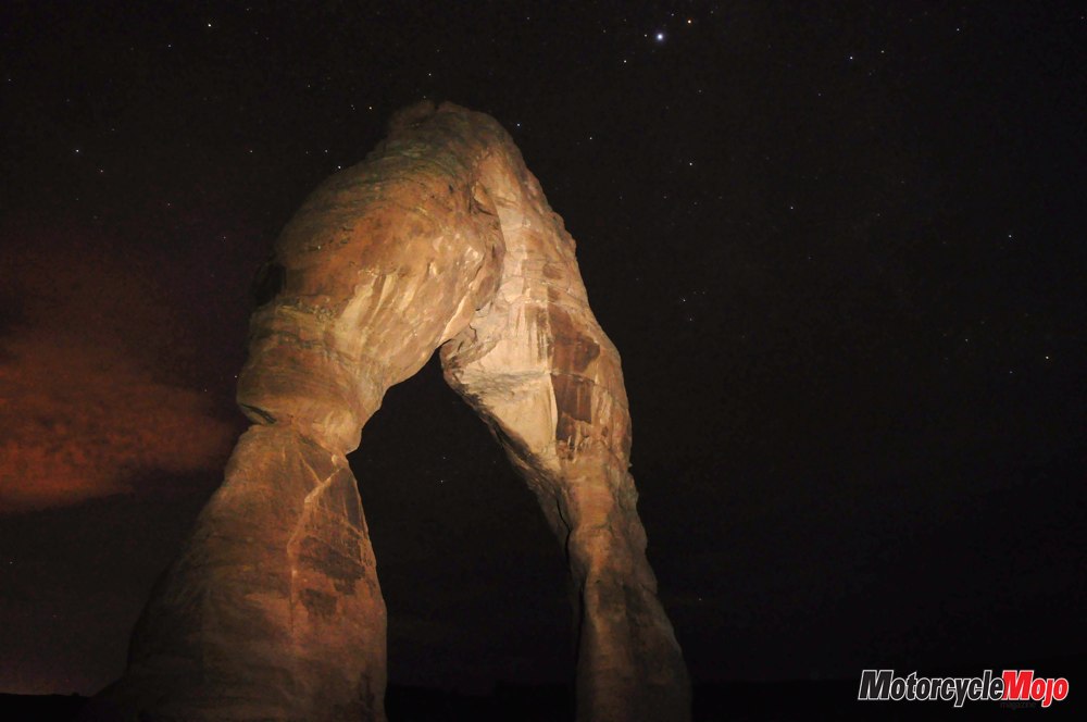
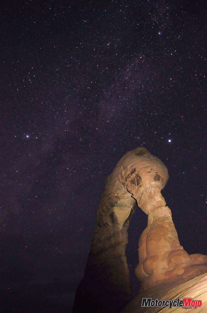
Riding through Canyonlands National Park, I marvelled at the vast expanse of buttes and canyons that stretched to the horizon, and soaked up the beauty of Mesa Arch as it overlooks Buck Canyon. Back at the Lazy Lizard, I called it an early night; I wanted to be up in the wee hours to try some more star photography in Arches National Park. When I was still awake at midnight, I waved a white pillowcase of surrender and got up. I could always sleep tomorrow. Even in the dark of the new moon, the 2.5 km trail to Delicate Arch was easy enough to follow among the foliage that bordered the path. It was when the trail crossed a vast section of slickrock that I had some trouble. Wandering blindly about on the featureless surface, I discovered the trail was marked with small cairns. The problem was, the distance between them was beyond the sweep of my headlamp’s beam. I had to do a lot of guesswork, avoiding sudden drop-offs into darkness, and sometimes ranging wide before coming upon the next marker. Once or twice I lost the trail, but I was careful never to venture so far as to be unable to return to the previous cairn and try again. It was painstaking work. I’m certain I retraced at least half the trail before finding the way forward. Just after 3 a.m., I arrived at the base of Delicate Arch.
Confined by the darkness, I crept forward on the rounded rock rim; it was like balancing on the back of a giant stone horse. Careful not to venture too near the point of no return, where it fell away into the unseen, I set up my tripod at several vantage points, trying to get the Arch and the Milky Way in the same frame. I was still engaged when the first early-morning hikers arrived just before dawn. As I made my way back down the trail, I was amazed at how easy it was to spot each cairn in the light of day. Exhausted and ready for bed, I still said a cheery good morning to the many visitors just setting out for Delicate Arch. But when I heard two or three complaining about the difficulty and length of the trail, it took a measure of self-control not to adjust their attitudes with a swing of my tripod.
There’s a Gas Station Where?
Back at the hostel, a new guest – a rider on a tired V-Star – had arrived. Realizing the most remote parts of my journey were behind me, and finding the unused jerry can to be a nuisance, I offered him the full container: he might be quite grateful for it on a lonely stretch of Utah highway. I, on the other hand, would rethink my magnanimity in Niagara Falls, New York (precisely 15 minutes from home), where, in my excitement to return after a month on the road, I somehow forgot about the gas gauge. As I stood roadside with my thumb out and my helmet at my feet, I shook my head. After all the planning, researching and outfitting, I had forgotten the most basic of travel tips: WTF (Watch the Fuel)!


Thanks for Reading
If you don’t already subscribe to Motorcycle Mojo we ask that you seriously think about it. We are Canada’s last mainstream motorcycle magazine that continuously provides a print and digital issue on a regular basis.
We offer exclusive content created by riders, for riders.
Our editorial staff consists of experienced industry veterans that produce trusted and respected coverage for readers from every walk of life.
Motorcycle Mojo Magazine is an award winning publication that provides premium content guaranteed to be of interest to every motorcycle enthusiast. Whether you prefer cruisers or adventure-touring, vintage or the latest models; riding round the world or just to work, Motorcycle Mojo covers every aspect of the motorcycle experience. Each issue of Motorcycle Mojo contains tests of new models, feature travel stories, compelling human interest articles, technical exposés, product reviews, as well as unique perspectives by regular columnists on safety or just everyday situations that may be stressful at the time but turn into fabulous campfire stories.
Thanks for considering a subscription. The Mojo team truly appreciates it.
