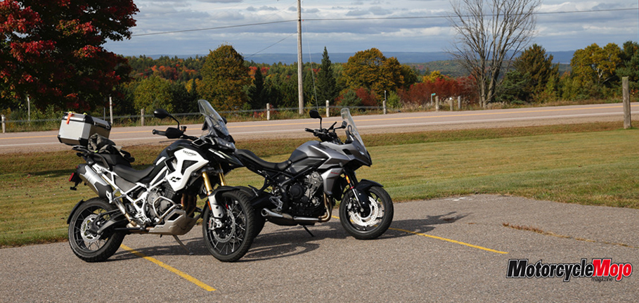
The Ontario Highlands is the perfect sandbox for these two playful cats.
Every year, my dad and I try to get out for a motorcycle trip together. Short or long, warm or cold; it doesn’t matter. It just so happens that he’s my favourite person to ride with and, although we live 4,000 km away from each other, we always find a way to make it work. As fate would have it, we found ourselves together through autumn in Ontario with two new Triumph Tigers to try out.
The Tiger 1200 Rally Pro and the Tiger 660 Sport — or the big tiger and little tiger — allow us to experience opposite ends of the tiger spectrum. I had ridden the 1200 before, but never the 660. The anticipation to ride the 660 was high: Since its release, I was excited to see how the little Tiger would handle. My only gripe was the name. I had a hard time calling it a Tiger based on Triumph’s recent re-establishment of the model as an all-adventure lineup. But I could easily be persuaded otherwise.
Fall Colours
As a child, autumn was my favourite season: the crisp air and endless colours sparked inspiration for me. It only seemed fitting that, for this trip, we would ride through thousands of acres of autumn’s most colourful palette, which also contains some of the best riding areas Ontario has to offer: the eastern part of the Haliburton Highlands and into the Ottawa Valley. We headed out for three days to experience the joy of childhood again.
In British Columbia, we have very little colour change, and although the bright yellow larches are spectacular, nothing quite compares to the sea of deciduous trees that becomes an array of colours once fall arrives and the weather gets colder.
Another bonus of the area is that these locales are a melting pot of rich history and diverse culture in Canada. It’s often overlooked, but every small town or roadside stop in the Ontario Highlands offers a unique look at the foundation on which much of modern Canadiana was built.
The All-Important Map

We skipped out on work early and headed north to Gooderham and then Barry’s Bay. We soon found ourselves on Elephant Lake Road and Peterson Road (one of the highlighted rides on the map), a twisty and curvy road that, despite bringing seemingly endless traffic, in the few instances without cars, also brought a smile to my face.
Dad decided that it would be a good time to use his GPS as it had seen little use before this trip. I’ve always struggled with the lack of focus gained from using a GPS. Fortunately, within a few short hours, the battery died without being plugged in, and we were left exploring roads the way they were meant to be explored: by map.
Squiggle Factor Wins Again
We scouted three roads that would usher us into Barry’s Bay. Based on the squiggle factor, we opted for Old Barry’s Bay Road and were not…


